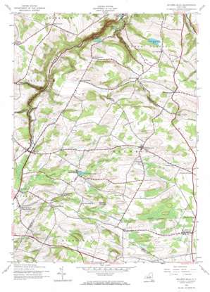
Millers Mills Topo Map New York
To zoom in, hover over the map of Millers Mills
USGS Topo Quad 42075h1 - 1:24,000 scale
| Topo Map Name: | Millers Mills |
| USGS Topo Quad ID: | 42075h1 |
| Print Size: | ca. 21 1/4" wide x 27" high |
| Southeast Coordinates: | 42.875° N latitude / 75° W longitude |
| Map Center Coordinates: | 42.9375° N latitude / 75.0625° W longitude |
| U.S. State: | NY |
| Filename: | o42075h1.jpg |
| Download Map JPG Image: | Millers Mills topo map 1:24,000 scale |
| Map Type: | Topographic |
| Topo Series: | 7.5´ |
| Map Scale: | 1:24,000 |
| Source of Map Images: | United States Geological Survey (USGS) |
| Alternate Map Versions: |
Millers Mills NY 1943, updated 1960 Download PDF Buy paper map Millers Mills NY 1943, updated 1970 Download PDF Buy paper map Millers Mills NY 2010 Download PDF Buy paper map Millers Mills NY 2013 Download PDF Buy paper map Millers Mills NY 2016 Download PDF Buy paper map |
1:24,000 Topo Quads surrounding Millers Mills
> Back to 42075e1 at 1:100,000 scale
> Back to 42074a1 at 1:250,000 scale
> Back to U.S. Topo Maps home
Millers Mills topo map: Gazetteer
Millers Mills: Lakes
Unadilla Lake elevation 405m 1328′Wheelock Pond elevation 156m 511′
Millers Mills: Populated Places
Cedarville elevation 371m 1217′Cedarville Station elevation 391m 1282′
Chepachet elevation 374m 1227′
Columbia Center elevation 455m 1492′
Cranes Corners elevation 430m 1410′
Dennison Corners elevation 398m 1305′
Elizabethtown elevation 390m 1279′
Getman Corners elevation 440m 1443′
McCoon Crossing elevation 445m 1459′
Millers Mills elevation 408m 1338′
Millers Mills Crossing elevation 425m 1394′
North Columbia elevation 375m 1230′
South Columbia elevation 445m 1459′
South Ilion elevation 166m 544′
Spinnerville elevation 384m 1259′
Youngs Crossing elevation 441m 1446′
Millers Mills: Reservoirs
Ilion Reservoir Number One elevation 219m 718′Ilion Reservoir Number Three elevation 284m 931′
Ilion Reservoir Number Two elevation 275m 902′
Millers Mills: Summits
Bell Hill elevation 373m 1223′Jones Hill elevation 466m 1528′
Joslin Hill elevation 454m 1489′
Monkey Mountain elevation 481m 1578′
Richfield Hill elevation 476m 1561′
Spoon Hill elevation 519m 1702′
Vickerman Hill elevation 348m 1141′
Millers Mills: Valleys
Beckus Gulf elevation 298m 977′Holcomb Gulf elevation 333m 1092′
Ilion Gorge elevation 152m 498′
Passage Gulf elevation 389m 1276′
Polly-Miller Gulf elevation 376m 1233′
Spinnerville Gulf elevation 152m 498′
Millers Mills digital topo map on disk
Buy this Millers Mills topo map showing relief, roads, GPS coordinates and other geographical features, as a high-resolution digital map file on DVD:
New York, Vermont, Connecticut & Western Massachusetts
Buy digital topo maps: New York, Vermont, Connecticut & Western Massachusetts


