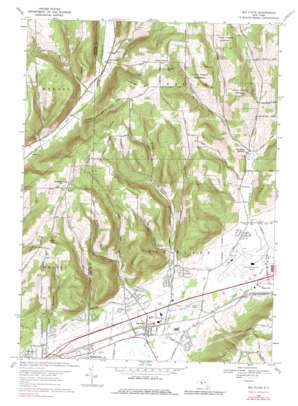
Big Flats Topo Map New York
To zoom in, hover over the map of Big Flats
USGS Topo Quad 42076b8 - 1:24,000 scale
| Topo Map Name: | Big Flats |
| USGS Topo Quad ID: | 42076b8 |
| Print Size: | ca. 21 1/4" wide x 27" high |
| Southeast Coordinates: | 42.125° N latitude / 76.875° W longitude |
| Map Center Coordinates: | 42.1875° N latitude / 76.9375° W longitude |
| U.S. State: | NY |
| Filename: | o42076b8.jpg |
| Download Map JPG Image: | Big Flats topo map 1:24,000 scale |
| Map Type: | Topographic |
| Topo Series: | 7.5´ |
| Map Scale: | 1:24,000 |
| Source of Map Images: | United States Geological Survey (USGS) |
| Alternate Map Versions: |
Big Flats NY 1953, updated 1955 Download PDF Buy paper map Big Flats NY 1953, updated 1964 Download PDF Buy paper map Big Flats NY 1969, updated 1971 Download PDF Buy paper map Big Flats NY 1969, updated 1979 Download PDF Buy paper map Big Flats NY 1969, updated 1979 Download PDF Buy paper map Big Flats NY 2010 Download PDF Buy paper map Big Flats NY 2013 Download PDF Buy paper map Big Flats NY 2016 Download PDF Buy paper map |
1:24,000 Topo Quads surrounding Big Flats
> Back to 42076a1 at 1:100,000 scale
> Back to 42076a1 at 1:250,000 scale
> Back to U.S. Topo Maps home
Big Flats topo map: Gazetteer
Big Flats: Airports
Elmira-Corning Regional Airport elevation 287m 941′Big Flats: Canals
Chemung Feeder Canal elevation 280m 918′Mud Ditch elevation 278m 912′
Big Flats: Lakes
Lowe Pond elevation 275m 902′Big Flats: Populated Places
Big Flats elevation 275m 902′Collingwood elevation 314m 1030′
East Corning elevation 276m 905′
Post Creek elevation 359m 1177′
Tompkins Corners elevation 319m 1046′
Big Flats: Streams
Cuthrie Run elevation 268m 879′Madison Creek elevation 311m 1020′
Winfield Creek elevation 280m 918′
Big Flats: Summits
Martin Hill elevation 579m 1899′Quackenbush Hill elevation 580m 1902′
Rose Hill elevation 545m 1788′
Townley Hill elevation 574m 1883′
Big Flats: Valleys
Breed Hollow elevation 295m 967′Eacher Hollow elevation 311m 1020′
Owen Hollow elevation 295m 967′
Reasor Hollow elevation 333m 1092′
Big Flats digital topo map on disk
Buy this Big Flats topo map showing relief, roads, GPS coordinates and other geographical features, as a high-resolution digital map file on DVD:
New York, Vermont, Connecticut & Western Massachusetts
Buy digital topo maps: New York, Vermont, Connecticut & Western Massachusetts


