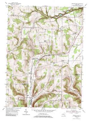
Beaver Dams Topo Map New York
To zoom in, hover over the map of Beaver Dams
USGS Topo Quad 42076c8 - 1:24,000 scale
| Topo Map Name: | Beaver Dams |
| USGS Topo Quad ID: | 42076c8 |
| Print Size: | ca. 21 1/4" wide x 27" high |
| Southeast Coordinates: | 42.25° N latitude / 76.875° W longitude |
| Map Center Coordinates: | 42.3125° N latitude / 76.9375° W longitude |
| U.S. State: | NY |
| Filename: | o42076c8.jpg |
| Download Map JPG Image: | Beaver Dams topo map 1:24,000 scale |
| Map Type: | Topographic |
| Topo Series: | 7.5´ |
| Map Scale: | 1:24,000 |
| Source of Map Images: | United States Geological Survey (USGS) |
| Alternate Map Versions: |
Beaver Dams NY 1953, updated 1955 Download PDF Buy paper map Beaver Dams NY 1953, updated 1967 Download PDF Buy paper map Beaver Dams NY 1953, updated 1986 Download PDF Buy paper map Beaver Dams NY 2010 Download PDF Buy paper map Beaver Dams NY 2013 Download PDF Buy paper map Beaver Dams NY 2016 Download PDF Buy paper map |
1:24,000 Topo Quads surrounding Beaver Dams
> Back to 42076a1 at 1:100,000 scale
> Back to 42076a1 at 1:250,000 scale
> Back to U.S. Topo Maps home
Beaver Dams topo map: Gazetteer
Beaver Dams: Airports
Tilden Airport elevation 318m 1043′Beaver Dams: Parks
Watkins Glen State Park elevation 291m 954′Beaver Dams: Populated Places
Beaver Dams elevation 385m 1263′Chambers elevation 367m 1204′
Cherry Lane elevation 393m 1289′
Moreland elevation 375m 1230′
Townsend elevation 403m 1322′
Wedgewood elevation 342m 1122′
Beaver Dams: Streams
East Creek elevation 363m 1190′Hamilton Creek elevation 302m 990′
Hemlock Run elevation 323m 1059′
Townsend Creek elevation 318m 1043′
Beaver Dams: Summits
Baker Hill elevation 522m 1712′Sugar Hill elevation 554m 1817′
Watkins Hill elevation 400m 1312′
Beaver Dams: Valleys
Van Zandt Hollow elevation 360m 1181′Beaver Dams digital topo map on disk
Buy this Beaver Dams topo map showing relief, roads, GPS coordinates and other geographical features, as a high-resolution digital map file on DVD:
New York, Vermont, Connecticut & Western Massachusetts
Buy digital topo maps: New York, Vermont, Connecticut & Western Massachusetts


