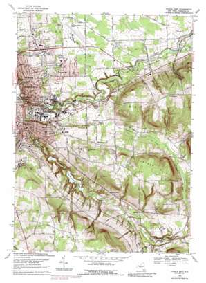
Ithaca East Topo Map New York
To zoom in, hover over the map of Ithaca East
USGS Topo Quad 42076d4 - 1:24,000 scale
| Topo Map Name: | Ithaca East |
| USGS Topo Quad ID: | 42076d4 |
| Print Size: | ca. 21 1/4" wide x 27" high |
| Southeast Coordinates: | 42.375° N latitude / 76.375° W longitude |
| Map Center Coordinates: | 42.4375° N latitude / 76.4375° W longitude |
| U.S. State: | NY |
| Filename: | o42076d4.jpg |
| Download Map JPG Image: | Ithaca East topo map 1:24,000 scale |
| Map Type: | Topographic |
| Topo Series: | 7.5´ |
| Map Scale: | 1:24,000 |
| Source of Map Images: | United States Geological Survey (USGS) |
| Alternate Map Versions: |
Ithaca East NY 1949, updated 1956 Download PDF Buy paper map Ithaca East NY 1949, updated 1966 Download PDF Buy paper map Ithaca East NY 1951 Download PDF Buy paper map Ithaca East NY 1969, updated 1972 Download PDF Buy paper map Ithaca East NY 1969, updated 1979 Download PDF Buy paper map Ithaca East NY 1969, updated 1988 Download PDF Buy paper map Ithaca East NY 2010 Download PDF Buy paper map Ithaca East NY 2013 Download PDF Buy paper map Ithaca East NY 2016 Download PDF Buy paper map |
1:24,000 Topo Quads surrounding Ithaca East
> Back to 42076a1 at 1:100,000 scale
> Back to 42076a1 at 1:250,000 scale
> Back to U.S. Topo Maps home
Ithaca East topo map: Gazetteer
Ithaca East: Airports
Keech Airport elevation 323m 1059′Tompkins County Airport elevation 329m 1079′
Ithaca East: Bridges
College Avenue Stone Arch Bridge elevation 202m 662′Dwyer Dam Bridge elevation 245m 803′
Eddy Dam Foot Bridge elevation 221m 725′
Judd Falls Bridge elevation 258m 846′
Sackett Foot Bridge elevation 238m 780′
Stewart Avenue Bridge elevation 156m 511′
Thurston Avenue Bridge elevation 203m 666′
Triphammer Foot Bridge elevation 213m 698′
Ithaca East: Dams
Van Nattas Dam elevation 144m 472′Ithaca East: Falls
Ithaca Falls elevation 133m 436′Ithaca East: Lakes
Beebe Lake elevation 238m 780′Ithaca East: Mines
Finger Lakes Quarry elevation 363m 1190′Ithaca East: Parks
Deans Garden elevation 268m 879′DeWitt Park elevation 123m 403′
Farrand Garden elevation 262m 859′
Hoy Field elevation 251m 823′
Kostrinsky Field elevation 314m 1030′
Muenscher Garden elevation 278m 912′
Peter Plaza elevation 250m 820′
Robert J Kane Sports Complex elevation 270m 885′
Robison Alumni Fields elevation 267m 875′
Rockwell Azalea Garden elevation 260m 853′
Schoellkopf Field elevation 257m 843′
Students Centennial Garden elevation 271m 889′
Thompson Park elevation 120m 393′
Treman Triangle Park elevation 127m 416′
Ithaca East: Populated Places
Besemer elevation 291m 954′Bethel Grove elevation 270m 885′
Brooktondale elevation 279m 915′
Cayuga Heights elevation 240m 787′
Country Manor Estates elevation 326m 1069′
East Ithaca elevation 245m 803′
Ellis elevation 330m 1082′
Etna elevation 311m 1020′
Fall Creek Parke elevation 306m 1003′
Forest Home elevation 281m 921′
Hibbards Corner elevation 334m 1095′
Hillside Acres Mobile Home Park elevation 293m 961′
Ithaca elevation 125m 410′
Lansing elevation 283m 928′
Renwick elevation 125m 410′
South Hill elevation 237m 777′
Varna elevation 285m 935′
Ithaca East: Reservoirs
Ithaca Reservoir elevation 217m 711′Ithaca East: Streams
Pleasant Grove Brook elevation 124m 406′Ithaca East: Summits
Comstock Knoll elevation 261m 856′Hungerford Hill elevation 389m 1276′
Mount Pleasant elevation 534m 1751′
Snyder Hill elevation 454m 1489′
Steventown Hill elevation 525m 1722′
Turkey Hill elevation 445m 1459′
Ithaca East digital topo map on disk
Buy this Ithaca East topo map showing relief, roads, GPS coordinates and other geographical features, as a high-resolution digital map file on DVD:
New York, Vermont, Connecticut & Western Massachusetts
Buy digital topo maps: New York, Vermont, Connecticut & Western Massachusetts


