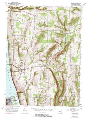
Burdett Topo Map New York
To zoom in, hover over the map of Burdett
USGS Topo Quad 42076d7 - 1:24,000 scale
| Topo Map Name: | Burdett |
| USGS Topo Quad ID: | 42076d7 |
| Print Size: | ca. 21 1/4" wide x 27" high |
| Southeast Coordinates: | 42.375° N latitude / 76.75° W longitude |
| Map Center Coordinates: | 42.4375° N latitude / 76.8125° W longitude |
| U.S. State: | NY |
| Filename: | o42076d7.jpg |
| Download Map JPG Image: | Burdett topo map 1:24,000 scale |
| Map Type: | Topographic |
| Topo Series: | 7.5´ |
| Map Scale: | 1:24,000 |
| Source of Map Images: | United States Geological Survey (USGS) |
| Alternate Map Versions: |
Burdett NY 1950, updated 1952 Download PDF Buy paper map Burdett NY 1950, updated 1962 Download PDF Buy paper map Burdett NY 1950, updated 1967 Download PDF Buy paper map Burdett NY 1950, updated 1990 Download PDF Buy paper map Burdett NY 2011 Download PDF Buy paper map Burdett NY 2013 Download PDF Buy paper map Burdett NY 2016 Download PDF Buy paper map |
| FStopo: | US Forest Service topo Burdett is available: Download FStopo PDF Download FStopo TIF |
1:24,000 Topo Quads surrounding Burdett
> Back to 42076a1 at 1:100,000 scale
> Back to 42076a1 at 1:250,000 scale
> Back to U.S. Topo Maps home
Burdett topo map: Gazetteer
Burdett: Airports
Eagle Ridge Airport elevation 453m 1486′Burdett: Capes
Glen Eldridge Point elevation 136m 446′Hector Falls Point elevation 136m 446′
Burdett: Falls
Hector Falls elevation 207m 679′Burdett: Parks
Lakeside Park elevation 136m 446′Burdett: Populated Places
Bennettsburg elevation 346m 1135′Burdett elevation 298m 977′
Butternut Park elevation 350m 1148′
Logan elevation 418m 1371′
Reynoldsville elevation 364m 1194′
Watkins Glen elevation 141m 462′
Burdett: Streams
Glen Creek elevation 135m 442′Hector Falls Creek elevation 135m 442′
Seneca Lake Inlet elevation 136m 446′
Burdett: Summits
Burnt Hill elevation 564m 1850′Foots Hill elevation 558m 1830′
North Hill elevation 532m 1745′
Rogers Hill elevation 586m 1922′
Satterly Hill elevation 431m 1414′
South Hill elevation 551m 1807′
Burdett: Trails
Burnt Hill Trail elevation 516m 1692′Finger Lakes Trail elevation 549m 1801′
Gorge Trail elevation 491m 1610′
Potomac Trail elevation 522m 1712′
Ravine Trail elevation 452m 1482′
South Slope Trail elevation 497m 1630′
Burdett: Valleys
Excelsior Glen elevation 142m 465′Glen Eldridge Tug Hollow elevation 135m 442′
Texas Hollow elevation 328m 1076′
Watkins Glen elevation 151m 495′
Burdett digital topo map on disk
Buy this Burdett topo map showing relief, roads, GPS coordinates and other geographical features, as a high-resolution digital map file on DVD:
New York, Vermont, Connecticut & Western Massachusetts
Buy digital topo maps: New York, Vermont, Connecticut & Western Massachusetts


