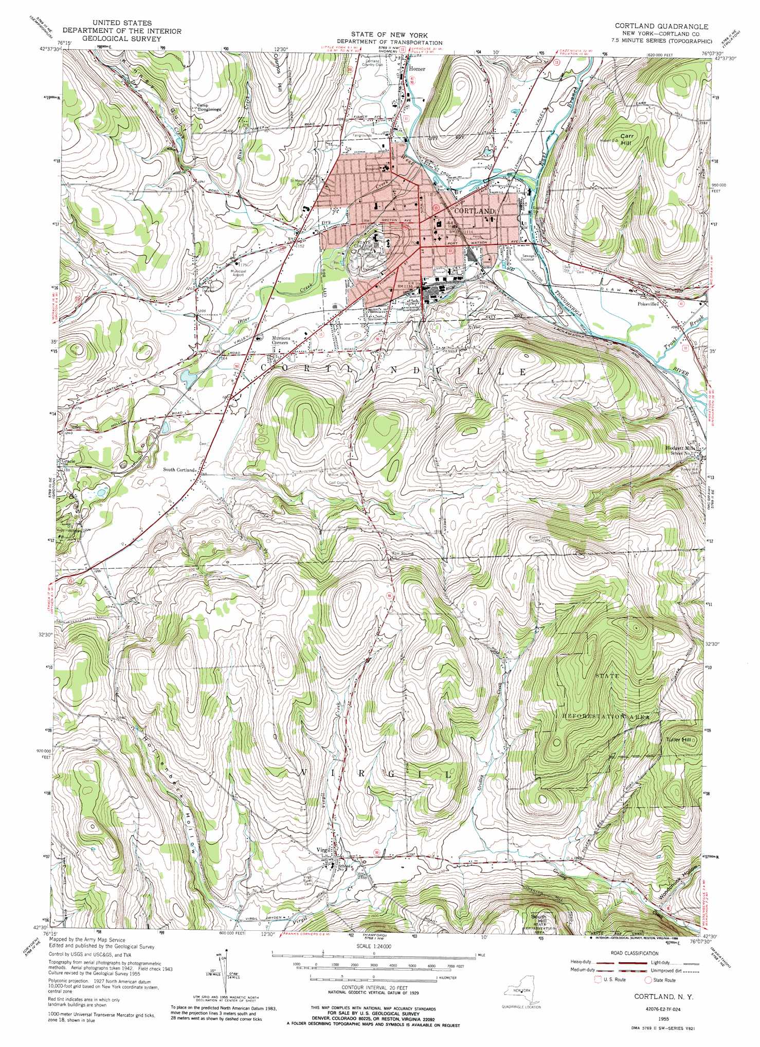
Cortland Topo Map New York
To zoom in, hover over the map of Cortland
USGS Topo Quad 42076e2 - 1:24,000 scale
| Topo Map Name: | Cortland |
| USGS Topo Quad ID: | 42076e2 |
| Print Size: | ca. 21 1/4" wide x 27" high |
| Southeast Coordinates: | 42.5° N latitude / 76.125° W longitude |
| Map Center Coordinates: | 42.5625° N latitude / 76.1875° W longitude |
| U.S. State: | NY |
| Filename: | o42076e2.jpg |
| Download Map JPG Image: | Cortland topo map 1:24,000 scale |
| Map Type: | Topographic |
| Topo Series: | 7.5´ |
| Map Scale: | 1:24,000 |
| Source of Map Images: | United States Geological Survey (USGS) |
| Alternate Map Versions: |
Cortland NY 1955, updated 1956 Download PDF Buy paper map Cortland NY 1955, updated 1966 Download PDF Buy paper map Cortland NY 1955, updated 1973 Download PDF Buy paper map Cortland NY 1955, updated 1988 Download PDF Buy paper map Cortland NY 2010 Download PDF Buy paper map Cortland NY 2013 Download PDF Buy paper map Cortland NY 2016 Download PDF Buy paper map |
1:24,000 Topo Quads surrounding Cortland
Owasco |
Spafford |
Otisco Valley |
Tully |
De Ruyter |
Moravia |
Sempronius |
Homer |
Truxton |
Cuyler |
West Groton |
Groton |
Cortland |
Mcgraw |
Cincinnatus |
Ithaca East |
Dryden |
Harford |
Marathon |
Willet |
Willseyville |
Speedsville |
Richford |
Lisle |
Whitney Point |
> Back to 42076e1 at 1:100,000 scale
> Back to 42076a1 at 1:250,000 scale
> Back to U.S. Topo Maps home
Cortland topo map: Gazetteer
Cortland: Airports
Cortland County Airport-Chase Field elevation 357m 1171′Cortland: Parks
Davis Field elevation 349m 1145′Holloway Field elevation 348m 1141′
Wallace Field elevation 349m 1145′
Cortland: Populated Places
Blodgett Mills elevation 336m 1102′Cortland elevation 344m 1128′
Gracie elevation 360m 1181′
Munsons Corners elevation 359m 1177′
Pokeville elevation 334m 1095′
South Cortland elevation 373m 1223′
Virgil elevation 428m 1404′
Cortland: Streams
Blue Creek elevation 362m 1187′Dry Creek elevation 335m 1099′
East Branch Tioughnioga River elevation 329m 1079′
Otter Creek elevation 335m 1099′
Trout Brook elevation 329m 1079′
West Branch Tioughnioga River elevation 329m 1079′
Cortland: Summits
Carr Hill elevation 483m 1584′South Hill elevation 635m 2083′
Tuller Hill elevation 616m 2020′
Cortland: Valleys
Hollenbeck Hollow elevation 405m 1328′Kinney Gulf elevation 352m 1154′
Woodchuck Hollow elevation 398m 1305′
Cortland digital topo map on disk
Buy this Cortland topo map showing relief, roads, GPS coordinates and other geographical features, as a high-resolution digital map file on DVD:
New York, Vermont, Connecticut & Western Massachusetts
Buy digital topo maps: New York, Vermont, Connecticut & Western Massachusetts