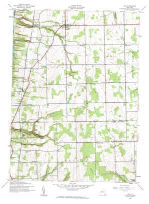
Lodi Topo Map New York
To zoom in, hover over the map of Lodi
USGS Topo Quad 42076e7 - 1:24,000 scale
| Topo Map Name: | Lodi |
| USGS Topo Quad ID: | 42076e7 |
| Print Size: | ca. 21 1/4" wide x 27" high |
| Southeast Coordinates: | 42.5° N latitude / 76.75° W longitude |
| Map Center Coordinates: | 42.5625° N latitude / 76.8125° W longitude |
| U.S. State: | NY |
| Filename: | o42076e7.jpg |
| Download Map JPG Image: | Lodi topo map 1:24,000 scale |
| Map Type: | Topographic |
| Topo Series: | 7.5´ |
| Map Scale: | 1:24,000 |
| Source of Map Images: | United States Geological Survey (USGS) |
| Alternate Map Versions: |
Lodi NY 1942, updated 1960 Download PDF Buy paper map Lodi NY 1942, updated 1960 Download PDF Buy paper map Lodi NY 2011 Download PDF Buy paper map Lodi NY 2013 Download PDF Buy paper map Lodi NY 2016 Download PDF Buy paper map |
| FStopo: | US Forest Service topo Lodi is available: Download FStopo PDF Download FStopo TIF |
1:24,000 Topo Quads surrounding Lodi
> Back to 42076e1 at 1:100,000 scale
> Back to 42076a1 at 1:250,000 scale
> Back to U.S. Topo Maps home
Lodi topo map: Gazetteer
Lodi: Falls
Silver Thread Falls elevation 180m 590′Lodi: Forests
Finger Lakes National Forest elevation 554m 1817′Green Mountain National Forest-Hector Ranger District elevation 508m 1666′
Lodi: Populated Places
Cat Elbow Corner elevation 330m 1082′Caywood elevation 260m 853′
East Steamburg elevation 470m 1541′
Hector elevation 260m 853′
Lodi elevation 337m 1105′
Lodi Center elevation 393m 1289′
Spaulding Corner elevation 423m 1387′
Townsendville elevation 436m 1430′
Lodi: Ridges
Hector Backbone elevation 554m 1817′Lodi: Summits
Butcher Hill elevation 482m 1581′Lodi: Trails
Interloken Trail elevation 558m 1830′Lodi digital topo map on disk
Buy this Lodi topo map showing relief, roads, GPS coordinates and other geographical features, as a high-resolution digital map file on DVD:
New York, Vermont, Connecticut & Western Massachusetts
Buy digital topo maps: New York, Vermont, Connecticut & Western Massachusetts


