Union Springs Topo Map New York
To zoom in, hover over the map of Union Springs
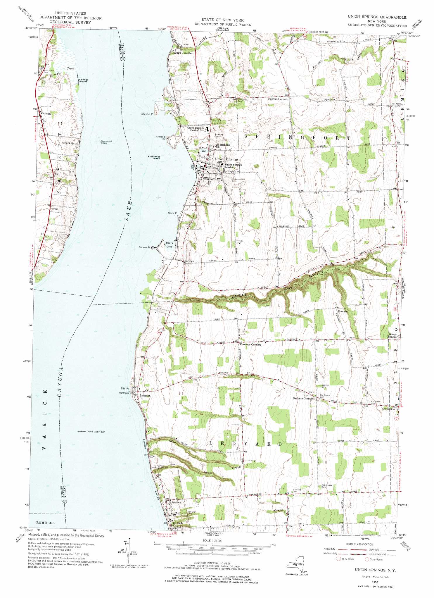
USGS Topo Quad 42076g6 - 1:24,000 scale
| Topo Map Name: | Union Springs |
| USGS Topo Quad ID: | 42076g6 |
| Print Size: | ca. 21 1/4" wide x 27" high |
| Southeast Coordinates: | 42.75° N latitude / 76.625° W longitude |
| Map Center Coordinates: | 42.8125° N latitude / 76.6875° W longitude |
| U.S. State: | NY |
| Filename: | o42076g6.jpg |
| Download Map JPG Image: | Union Springs topo map 1:24,000 scale |
| Map Type: | Topographic |
| Topo Series: | 7.5´ |
| Map Scale: | 1:24,000 |
| Source of Map Images: | United States Geological Survey (USGS) |
| Alternate Map Versions: |
Union Springs NY 1955, updated 1957 Download PDF Buy paper map Union Springs NY 1955, updated 1967 Download PDF Buy paper map Union Springs NY 1955, updated 1976 Download PDF Buy paper map Union Springs NY 2010 Download PDF Buy paper map Union Springs NY 2013 Download PDF Buy paper map Union Springs NY 2016 Download PDF Buy paper map |
1:24,000 Topo Quads surrounding Union Springs
Lyons |
Savannah |
Montezuma |
Weedsport |
Jordan |
Geneva North |
Seneca Falls |
Cayuga |
Auburn |
Skaneateles |
Geneva South |
Romulus |
Union Springs |
Scipio Center |
Owasco |
Dresden |
Ovid |
Sheldrake |
Genoa |
Moravia |
Dundee |
Lodi |
Trumansburg |
Ludlowville |
West Groton |
> Back to 42076e1 at 1:100,000 scale
> Back to 42076a1 at 1:250,000 scale
> Back to U.S. Topo Maps home
Union Springs topo map: Gazetteer
Union Springs: Airports
Saint Bernard Field elevation 161m 528′Union Springs: Bays
Carrs Cove elevation 116m 380′Union Springs: Capes
Allens Point elevation 119m 390′Ellis Point elevation 116m 380′
Farleys Point elevation 121m 396′
Hibiscus Point elevation 123m 403′
Howland Point elevation 122m 400′
Union Springs: Islands
Canoga Island elevation 116m 380′Frontenac Island elevation 116m 380′
Union Springs: Populated Places
Aurora elevation 126m 413′Bunker elevation 260m 853′
Canoga elevation 137m 449′
Cayuga Junction elevation 119m 390′
Farleys elevation 128m 419′
Levanna elevation 129m 423′
Powers Corner elevation 178m 583′
Union Springs elevation 125m 410′
Union Springs: Streams
Canoga Creek elevation 116m 380′Dean Creek elevation 117m 383′
Glen Creek elevation 116m 380′
Union Springs: Valleys
Great Gully elevation 119m 390′Union Springs digital topo map on disk
Buy this Union Springs topo map showing relief, roads, GPS coordinates and other geographical features, as a high-resolution digital map file on DVD:
New York, Vermont, Connecticut & Western Massachusetts
Buy digital topo maps: New York, Vermont, Connecticut & Western Massachusetts