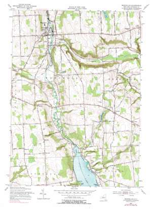
Marcellus Topo Map New York
To zoom in, hover over the map of Marcellus
USGS Topo Quad 42076h3 - 1:24,000 scale
| Topo Map Name: | Marcellus |
| USGS Topo Quad ID: | 42076h3 |
| Print Size: | ca. 21 1/4" wide x 27" high |
| Southeast Coordinates: | 42.875° N latitude / 76.25° W longitude |
| Map Center Coordinates: | 42.9375° N latitude / 76.3125° W longitude |
| U.S. State: | NY |
| Filename: | o42076h3.jpg |
| Download Map JPG Image: | Marcellus topo map 1:24,000 scale |
| Map Type: | Topographic |
| Topo Series: | 7.5´ |
| Map Scale: | 1:24,000 |
| Source of Map Images: | United States Geological Survey (USGS) |
| Alternate Map Versions: |
Marcellus NY 1955, updated 1957 Download PDF Buy paper map Marcellus NY 1955, updated 1966 Download PDF Buy paper map Marcellus NY 1955, updated 1978 Download PDF Buy paper map Marcellus NY 1955, updated 1978 Download PDF Buy paper map Marcellus NY 2010 Download PDF Buy paper map Marcellus NY 2013 Download PDF Buy paper map Marcellus NY 2016 Download PDF Buy paper map |
1:24,000 Topo Quads surrounding Marcellus
> Back to 42076e1 at 1:100,000 scale
> Back to 42076a1 at 1:250,000 scale
> Back to U.S. Topo Maps home
Marcellus topo map: Gazetteer
Marcellus: Bays
Glen Cove elevation 252m 826′Marcellus: Capes
Fitzgerald Point elevation 243m 797′Lader Point elevation 244m 800′
Marcellus: Channels
The Narrows elevation 240m 787′Marcellus: Lakes
Mud Pond elevation 313m 1026′Marcellus: Populated Places
Amber elevation 245m 803′Cards Corners elevation 281m 921′
Clintonville elevation 335m 1099′
Heath Grove elevation 249m 816′
Marcellus elevation 208m 682′
Marietta elevation 243m 797′
Navarino elevation 351m 1151′
Rose Hill elevation 378m 1240′
Shamrock elevation 379m 1243′
Thorn Hill elevation 393m 1289′
Wellington Corner elevation 299m 980′
Marcellus: Reservoirs
Otisco Lake elevation 240m 787′Rockwell Springs elevation 305m 1000′
Smith Hollow Pond elevation 303m 994′
Marcellus: Streams
Amber Brook elevation 240m 787′Van Benthuysen Brook elevation 240m 787′
Willow Brook elevation 241m 790′
Marcellus: Summits
Baker Hill elevation 330m 1082′Bishop Hill elevation 257m 843′
Howlett Hill elevation 344m 1128′
Marcellus: Valleys
Pumpkin Hollow elevation 201m 659′Smith Hollow elevation 283m 928′
Tyler Hollow elevation 213m 698′
Willow Dale elevation 242m 793′
Marcellus digital topo map on disk
Buy this Marcellus topo map showing relief, roads, GPS coordinates and other geographical features, as a high-resolution digital map file on DVD:
New York, Vermont, Connecticut & Western Massachusetts
Buy digital topo maps: New York, Vermont, Connecticut & Western Massachusetts


