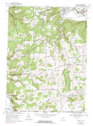
Caton Topo Map New York
To zoom in, hover over the map of Caton
USGS Topo Quad 42077a1 - 1:24,000 scale
| Topo Map Name: | Caton |
| USGS Topo Quad ID: | 42077a1 |
| Print Size: | ca. 21 1/4" wide x 27" high |
| Southeast Coordinates: | 42° N latitude / 77° W longitude |
| Map Center Coordinates: | 42.0625° N latitude / 77.0625° W longitude |
| U.S. States: | NY, PA |
| Filename: | o42077a1.jpg |
| Download Map JPG Image: | Caton topo map 1:24,000 scale |
| Map Type: | Topographic |
| Topo Series: | 7.5´ |
| Map Scale: | 1:24,000 |
| Source of Map Images: | United States Geological Survey (USGS) |
| Alternate Map Versions: |
Caton NY 1953, updated 1955 Download PDF Buy paper map Caton NY 1953, updated 1965 Download PDF Buy paper map Caton NY 1969, updated 1971 Download PDF Buy paper map Caton NY 1969, updated 1990 Download PDF Buy paper map Caton NY 2010 Download PDF Buy paper map Caton NY 2013 Download PDF Buy paper map Caton NY 2016 Download PDF Buy paper map |
1:24,000 Topo Quads surrounding Caton
> Back to 42077a1 at 1:100,000 scale
> Back to 42076a1 at 1:250,000 scale
> Back to U.S. Topo Maps home
Caton topo map: Gazetteer
Caton: Populated Places
Browntown elevation 494m 1620′Caton elevation 434m 1423′
Corning Manor elevation 284m 931′
East Lindley elevation 388m 1272′
South Corning elevation 290m 951′
West Caton elevation 426m 1397′
Caton: Streams
Bailey Creek elevation 280m 918′Barnard Creek elevation 337m 1105′
Caton Creek elevation 310m 1017′
Cowanesque River elevation 297m 974′
Steamtown Creek elevation 297m 974′
Whisky Creek elevation 270m 885′
Caton: Summits
Forest Hill elevation 531m 1742′Martin Hill elevation 530m 1738′
Spencer Hill elevation 534m 1751′
Caton: Swamps
Caton Swamp elevation 429m 1407′Caton: Valleys
Brown Hollow elevation 287m 941′Caton digital topo map on disk
Buy this Caton topo map showing relief, roads, GPS coordinates and other geographical features, as a high-resolution digital map file on DVD:
New York, Vermont, Connecticut & Western Massachusetts
Buy digital topo maps: New York, Vermont, Connecticut & Western Massachusetts


