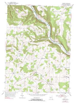
Cameron Topo Map New York
To zoom in, hover over the map of Cameron
USGS Topo Quad 42077b4 - 1:24,000 scale
| Topo Map Name: | Cameron |
| USGS Topo Quad ID: | 42077b4 |
| Print Size: | ca. 21 1/4" wide x 27" high |
| Southeast Coordinates: | 42.125° N latitude / 77.375° W longitude |
| Map Center Coordinates: | 42.1875° N latitude / 77.4375° W longitude |
| U.S. State: | NY |
| Filename: | o42077b4.jpg |
| Download Map JPG Image: | Cameron topo map 1:24,000 scale |
| Map Type: | Topographic |
| Topo Series: | 7.5´ |
| Map Scale: | 1:24,000 |
| Source of Map Images: | United States Geological Survey (USGS) |
| Alternate Map Versions: |
Cameron NY 1953, updated 1954 Download PDF Buy paper map Cameron NY 1953, updated 1967 Download PDF Buy paper map Cameron NY 1953, updated 1990 Download PDF Buy paper map Cameron NY 2010 Download PDF Buy paper map Cameron NY 2013 Download PDF Buy paper map Cameron NY 2016 Download PDF Buy paper map |
1:24,000 Topo Quads surrounding Cameron
> Back to 42077a1 at 1:100,000 scale
> Back to 42076a1 at 1:250,000 scale
> Back to U.S. Topo Maps home
Cameron topo map: Gazetteer
Cameron: Populated Places
Browns Crossing elevation 329m 1079′Cameron elevation 326m 1069′
Hedgesville elevation 434m 1423′
South Cameron elevation 546m 1791′
West Cameron elevation 321m 1053′
Cameron: Streams
Talbot Creek elevation 456m 1496′Cameron: Summits
Averell Hill elevation 569m 1866′Cobble Knob elevation 523m 1715′
Kinners Knob elevation 620m 2034′
Cameron digital topo map on disk
Buy this Cameron topo map showing relief, roads, GPS coordinates and other geographical features, as a high-resolution digital map file on DVD:
New York, Vermont, Connecticut & Western Massachusetts
Buy digital topo maps: New York, Vermont, Connecticut & Western Massachusetts


