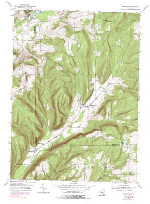
Bradford Topo Map New York
To zoom in, hover over the map of Bradford
USGS Topo Quad 42077c1 - 1:24,000 scale
| Topo Map Name: | Bradford |
| USGS Topo Quad ID: | 42077c1 |
| Print Size: | ca. 21 1/4" wide x 27" high |
| Southeast Coordinates: | 42.25° N latitude / 77° W longitude |
| Map Center Coordinates: | 42.3125° N latitude / 77.0625° W longitude |
| U.S. State: | NY |
| Filename: | o42077c1.jpg |
| Download Map JPG Image: | Bradford topo map 1:24,000 scale |
| Map Type: | Topographic |
| Topo Series: | 7.5´ |
| Map Scale: | 1:24,000 |
| Source of Map Images: | United States Geological Survey (USGS) |
| Alternate Map Versions: |
Bradford NY 1953, updated 1955 Download PDF Buy paper map Bradford NY 1953, updated 1965 Download PDF Buy paper map Bradford NY 1953, updated 1991 Download PDF Buy paper map Bradford NY 2010 Download PDF Buy paper map Bradford NY 2013 Download PDF Buy paper map Bradford NY 2016 Download PDF Buy paper map |
1:24,000 Topo Quads surrounding Bradford
> Back to 42077a1 at 1:100,000 scale
> Back to 42076a1 at 1:250,000 scale
> Back to U.S. Topo Maps home
Bradford topo map: Gazetteer
Bradford: Airports
Ultralight Flight Farm elevation 366m 1200′Bradford: Lakes
Cinnamon Lake elevation 557m 1827′Bradford: Populated Places
Bradford elevation 341m 1118′Meads Creek elevation 344m 1128′
Monterey elevation 371m 1217′
Pine Creek elevation 457m 1499′
Bradford: Reservoirs
Mill Pond elevation 338m 1108′Bradford: Streams
Pine Creek elevation 356m 1167′Bradford digital topo map on disk
Buy this Bradford topo map showing relief, roads, GPS coordinates and other geographical features, as a high-resolution digital map file on DVD:
New York, Vermont, Connecticut & Western Massachusetts
Buy digital topo maps: New York, Vermont, Connecticut & Western Massachusetts


