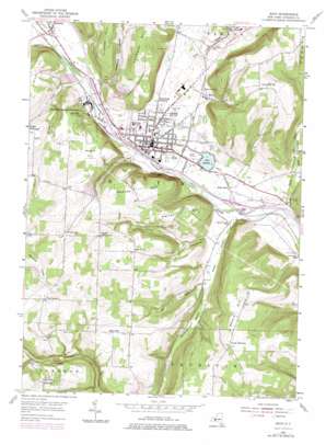
Bath Topo Map New York
To zoom in, hover over the map of Bath
USGS Topo Quad 42077c3 - 1:24,000 scale
| Topo Map Name: | Bath |
| USGS Topo Quad ID: | 42077c3 |
| Print Size: | ca. 21 1/4" wide x 27" high |
| Southeast Coordinates: | 42.25° N latitude / 77.25° W longitude |
| Map Center Coordinates: | 42.3125° N latitude / 77.3125° W longitude |
| U.S. State: | NY |
| Filename: | o42077c3.jpg |
| Download Map JPG Image: | Bath topo map 1:24,000 scale |
| Map Type: | Topographic |
| Topo Series: | 7.5´ |
| Map Scale: | 1:24,000 |
| Source of Map Images: | United States Geological Survey (USGS) |
| Alternate Map Versions: |
Bath NY 1953, updated 1955 Download PDF Buy paper map Bath NY 1953, updated 1967 Download PDF Buy paper map Bath NY 1953, updated 1978 Download PDF Buy paper map Bath NY 2010 Download PDF Buy paper map Bath NY 2013 Download PDF Buy paper map Bath NY 2016 Download PDF Buy paper map |
1:24,000 Topo Quads surrounding Bath
> Back to 42077a1 at 1:100,000 scale
> Back to 42076a1 at 1:250,000 scale
> Back to U.S. Topo Maps home
Bath topo map: Gazetteer
Bath: Airports
Jolamtra Landing Area elevation 520m 1706′Bath: Cliffs
Mossy Bank elevation 421m 1381′Bath: Lakes
Lake Salubria elevation 331m 1085′Bath: Mines
Bath Quarry elevation 428m 1404′Bath: Populated Places
Bath elevation 338m 1108′Bonny Hill elevation 538m 1765′
Cold Springs elevation 314m 1030′
Coss Corners elevation 543m 1781′
Dudley Settlement elevation 476m 1561′
East Union elevation 506m 1660′
Haverling Heights elevation 347m 1138′
Kanona elevation 349m 1145′
Lake Country Estates elevation 343m 1125′
North Cameron elevation 494m 1620′
North Thurston elevation 545m 1788′
The Homes Of Wildflower Hills elevation 347m 1138′
Unionville elevation 482m 1581′
Bath: Streams
Campbell Creek elevation 344m 1128′Culver Creek elevation 337m 1105′
Fivemile Creek elevation 345m 1131′
Gulf Creek elevation 351m 1151′
Knight Creek elevation 342m 1122′
Smith Run elevation 323m 1059′
Stocking Creek elevation 326m 1069′
Bath: Summits
Herron Hill elevation 507m 1663′Magees Hill elevation 486m 1594′
Peters Hill elevation 555m 1820′
Sharps Hill elevation 514m 1686′
Bath: Valleys
Babcock Hollow elevation 340m 1115′Freeman Hollow elevation 328m 1076′
Harrisburg Hollow elevation 348m 1141′
Bath digital topo map on disk
Buy this Bath topo map showing relief, roads, GPS coordinates and other geographical features, as a high-resolution digital map file on DVD:
New York, Vermont, Connecticut & Western Massachusetts
Buy digital topo maps: New York, Vermont, Connecticut & Western Massachusetts


