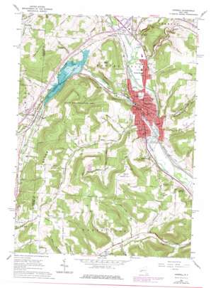
Hornell Topo Map New York
To zoom in, hover over the map of Hornell
USGS Topo Quad 42077c6 - 1:24,000 scale
| Topo Map Name: | Hornell |
| USGS Topo Quad ID: | 42077c6 |
| Print Size: | ca. 21 1/4" wide x 27" high |
| Southeast Coordinates: | 42.25° N latitude / 77.625° W longitude |
| Map Center Coordinates: | 42.3125° N latitude / 77.6875° W longitude |
| U.S. State: | NY |
| Filename: | o42077c6.jpg |
| Download Map JPG Image: | Hornell topo map 1:24,000 scale |
| Map Type: | Topographic |
| Topo Series: | 7.5´ |
| Map Scale: | 1:24,000 |
| Source of Map Images: | United States Geological Survey (USGS) |
| Alternate Map Versions: |
Hornell NY 1965, updated 1967 Download PDF Buy paper map Hornell NY 1965, updated 1977 Download PDF Buy paper map Hornell NY 1978, updated 1978 Download PDF Buy paper map Hornell NY 2010 Download PDF Buy paper map Hornell NY 2013 Download PDF Buy paper map Hornell NY 2016 Download PDF Buy paper map |
1:24,000 Topo Quads surrounding Hornell
> Back to 42077a1 at 1:100,000 scale
> Back to 42076a1 at 1:250,000 scale
> Back to U.S. Topo Maps home
Hornell topo map: Gazetteer
Hornell: Canals
Marsh Ditch elevation 357m 1171′Hornell: Parks
Maple City Park elevation 353m 1158′Union Park elevation 355m 1164′
Hornell: Populated Places
Almond elevation 407m 1335′Bishopville elevation 422m 1384′
Hornell elevation 354m 1161′
North Hornell elevation 355m 1164′
South Hornell elevation 353m 1158′
Webbs Crossing elevation 358m 1174′
Hornell: Reservoirs
Almond Lake elevation 386m 1266′Canisteo Reservoir elevation 391m 1282′
Hornell: Streams
Big Creek elevation 349m 1145′Canacadea Creek elevation 342m 1122′
Chauncey Run elevation 345m 1131′
Crosby Creek elevation 344m 1128′
Honey Run elevation 385m 1263′
Karr Valley Creek elevation 404m 1325′
Seeley Creek elevation 354m 1161′
Hornell: Summits
Ashbaugh Hill elevation 504m 1653′Bald Hill elevation 568m 1863′
Cook Hill elevation 644m 2112′
Hartsville Hill elevation 690m 2263′
Hinkley Hill elevation 620m 2034′
Meeks Hill elevation 636m 2086′
Newcomb Hill elevation 634m 2080′
Pennsylvania Hill elevation 586m 1922′
Tobes Hill elevation 598m 1961′
Hornell: Valleys
Bear Lick Hollow elevation 421m 1381′Hornell digital topo map on disk
Buy this Hornell topo map showing relief, roads, GPS coordinates and other geographical features, as a high-resolution digital map file on DVD:
New York, Vermont, Connecticut & Western Massachusetts
Buy digital topo maps: New York, Vermont, Connecticut & Western Massachusetts


