Alfred Topo Map New York
To zoom in, hover over the map of Alfred
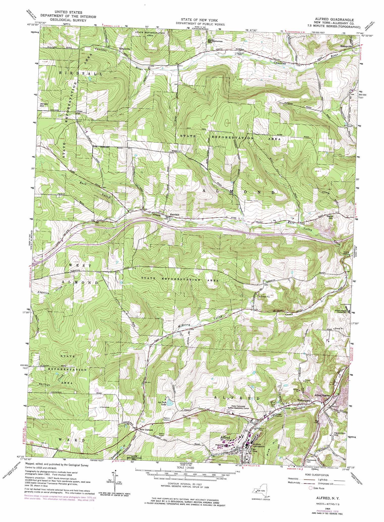
USGS Topo Quad 42077c7 - 1:24,000 scale
| Topo Map Name: | Alfred |
| USGS Topo Quad ID: | 42077c7 |
| Print Size: | ca. 21 1/4" wide x 27" high |
| Southeast Coordinates: | 42.25° N latitude / 77.75° W longitude |
| Map Center Coordinates: | 42.3125° N latitude / 77.8125° W longitude |
| U.S. State: | NY |
| Filename: | o42077c7.jpg |
| Download Map JPG Image: | Alfred topo map 1:24,000 scale |
| Map Type: | Topographic |
| Topo Series: | 7.5´ |
| Map Scale: | 1:24,000 |
| Source of Map Images: | United States Geological Survey (USGS) |
| Alternate Map Versions: |
Alfred NY 1964, updated 1965 Download PDF Buy paper map Alfred NY 1964, updated 1975 Download PDF Buy paper map Alfred NY 1964, updated 1978 Download PDF Buy paper map Alfred NY 2010 Download PDF Buy paper map Alfred NY 2013 Download PDF Buy paper map Alfred NY 2016 Download PDF Buy paper map |
1:24,000 Topo Quads surrounding Alfred
Portageville |
Nunda |
Ossian |
Dansville |
Wayland |
Fillmore |
Birdsall |
Canaseraga |
Arkport |
Haskinville |
Angelica |
West Almond |
Alfred |
Hornell |
Canisteo |
Belmont |
Wellsville North |
Andover |
Greenwood |
South Canisteo |
Allentown |
Wellsville South |
Whitesville |
Rexville |
Troupsburg |
> Back to 42077a1 at 1:100,000 scale
> Back to 42076a1 at 1:250,000 scale
> Back to U.S. Topo Maps home
Alfred topo map: Gazetteer
Alfred: Lakes
Ag-Tech Lake elevation 655m 2148′Alfred: Parks
Alfred Village Historic District elevation 545m 1788′Merrill Field elevation 516m 1692′
Alfred: Populated Places
Alfred elevation 538m 1765′Alfred Station elevation 501m 1643′
Hiltonville elevation 510m 1673′
Karrdale elevation 501m 1643′
Tinkertown elevation 485m 1591′
Alfred: Streams
McHenry Valley Creek elevation 414m 1358′Alfred: Summits
Hamilton Hill elevation 538m 1765′Jersey Hill elevation 685m 2247′
Pine Hill elevation 666m 2185′
Sand Hill elevation 494m 1620′
Alfred digital topo map on disk
Buy this Alfred topo map showing relief, roads, GPS coordinates and other geographical features, as a high-resolution digital map file on DVD:
New York, Vermont, Connecticut & Western Massachusetts
Buy digital topo maps: New York, Vermont, Connecticut & Western Massachusetts