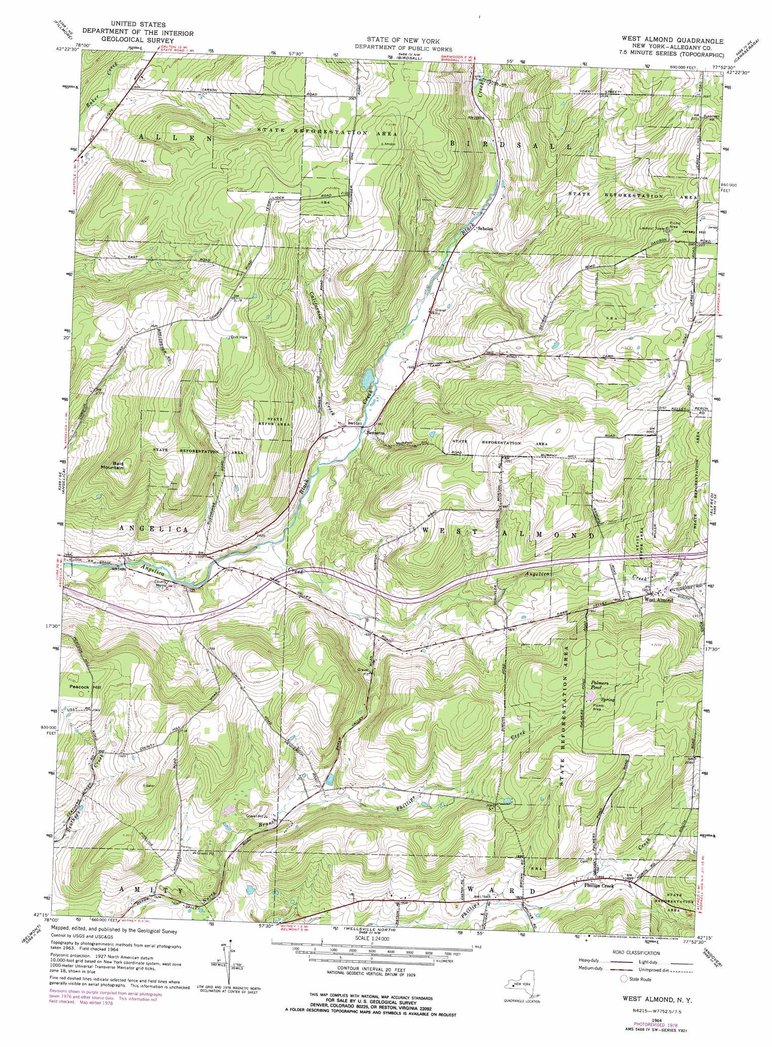
West Almond Topo Map New York
To zoom in, hover over the map of West Almond
USGS Topo Quad 42077c8 - 1:24,000 scale
| Topo Map Name: | West Almond |
| USGS Topo Quad ID: | 42077c8 |
| Print Size: | ca. 21 1/4" wide x 27" high |
| Southeast Coordinates: | 42.25° N latitude / 77.875° W longitude |
| Map Center Coordinates: | 42.3125° N latitude / 77.9375° W longitude |
| U.S. State: | NY |
| Filename: | o42077c8.jpg |
| Download Map JPG Image: | West Almond topo map 1:24,000 scale |
| Map Type: | Topographic |
| Topo Series: | 7.5´ |
| Map Scale: | 1:24,000 |
| Source of Map Images: | United States Geological Survey (USGS) |
| Alternate Map Versions: |
West Almond NY 1964, updated 1966 Download PDF Buy paper map West Almond NY 1964, updated 1978 Download PDF Buy paper map West Almond NY 2010 Download PDF Buy paper map West Almond NY 2013 Download PDF Buy paper map West Almond NY 2016 Download PDF Buy paper map |
1:24,000 Topo Quads surrounding West Almond
Pike |
Portageville |
Nunda |
Ossian |
Dansville |
Houghton |
Fillmore |
Birdsall |
Canaseraga |
Arkport |
Black Creek |
Angelica |
West Almond |
Alfred |
Hornell |
Friendship |
Belmont |
Wellsville North |
Andover |
Greenwood |
Bolivar |
Allentown |
Wellsville South |
Whitesville |
Rexville |
> Back to 42077a1 at 1:100,000 scale
> Back to 42076a1 at 1:250,000 scale
> Back to U.S. Topo Maps home
West Almond topo map: Gazetteer
West Almond: Lakes
Palmers Pond elevation 642m 2106′West Almond: Populated Places
Bennetts elevation 486m 1594′Phillips Creek elevation 567m 1860′
Scholes elevation 497m 1630′
West Almond elevation 565m 1853′
West Almond: Streams
Black Creek elevation 463m 1519′California Creek elevation 478m 1568′
West Almond: Summits
Bald Mountain elevation 641m 2103′Peacock Hill elevation 641m 2103′
West Almond digital topo map on disk
Buy this West Almond topo map showing relief, roads, GPS coordinates and other geographical features, as a high-resolution digital map file on DVD:
New York, Vermont, Connecticut & Western Massachusetts
Buy digital topo maps: New York, Vermont, Connecticut & Western Massachusetts