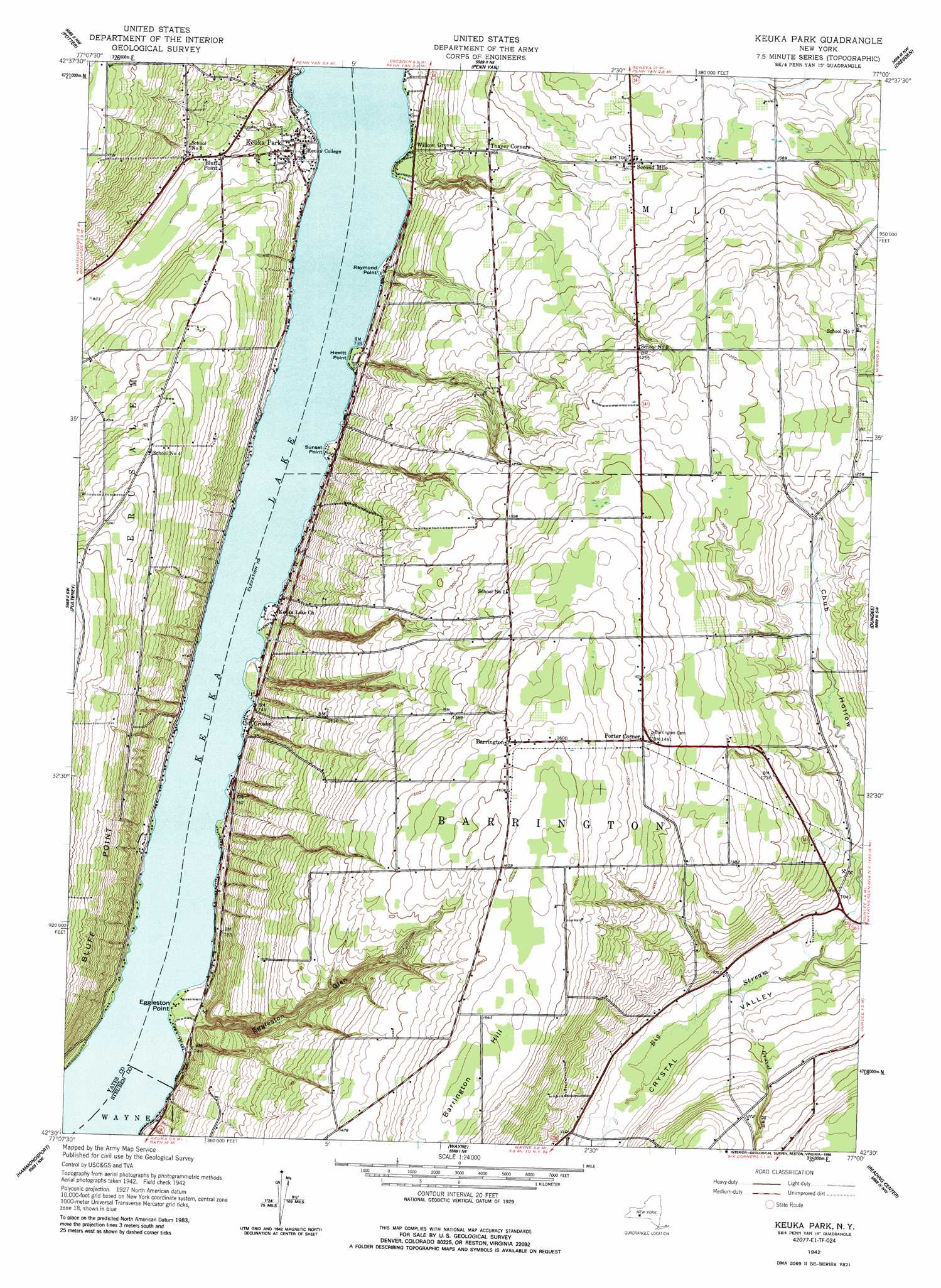
Keuka Park Topo Map New York
To zoom in, hover over the map of Keuka Park
USGS Topo Quad 42077e1 - 1:24,000 scale
| Topo Map Name: | Keuka Park |
| USGS Topo Quad ID: | 42077e1 |
| Print Size: | ca. 21 1/4" wide x 27" high |
| Southeast Coordinates: | 42.5° N latitude / 77° W longitude |
| Map Center Coordinates: | 42.5625° N latitude / 77.0625° W longitude |
| U.S. State: | NY |
| Filename: | o42077e1.jpg |
| Download Map JPG Image: | Keuka Park topo map 1:24,000 scale |
| Map Type: | Topographic |
| Topo Series: | 7.5´ |
| Map Scale: | 1:24,000 |
| Source of Map Images: | United States Geological Survey (USGS) |
| Alternate Map Versions: |
Keuka Park NY 1942, updated 1960 Download PDF Buy paper map Keuka Park NY 1942, updated 1988 Download PDF Buy paper map Keuka Park NY 1942, updated 1988 Download PDF Buy paper map Keuka Park NY 2010 Download PDF Buy paper map Keuka Park NY 2013 Download PDF Buy paper map Keuka Park NY 2016 Download PDF Buy paper map |
1:24,000 Topo Quads surrounding Keuka Park
Canandaigua Lake |
Rushville |
Stanley |
Geneva South |
Romulus |
Middlesex |
Potter |
Penn Yan |
Dresden |
Ovid |
Prattsburg |
Pulteney |
Keuka Park |
Dundee |
Lodi |
Rheims |
Hammondsport |
Wayne |
Reading Center |
Burdett |
Bath |
Savona |
Bradford |
Beaver Dams |
Montour Falls |
> Back to 42077e1 at 1:100,000 scale
> Back to 42076a1 at 1:250,000 scale
> Back to U.S. Topo Maps home
Keuka Park topo map: Gazetteer
Keuka Park: Capes
Eggleston Point elevation 221m 725′Hewitt Point elevation 222m 728′
Raymond Point elevation 219m 718′
Sunset Point elevation 222m 728′
Keuka Park: Lakes
Keuka Lake elevation 218m 715′Keuka Park: Populated Places
Barrington elevation 477m 1564′Bluff Point elevation 250m 820′
Crosby elevation 226m 741′
Keuka Park elevation 236m 774′
Porter Corner elevation 447m 1466′
Second Milo elevation 323m 1059′
Willow Grove elevation 231m 757′
Keuka Park: Streams
Gravel Run elevation 310m 1017′Keuka Park: Valleys
Eggleston Glen elevation 224m 734′Keuka Park digital topo map on disk
Buy this Keuka Park topo map showing relief, roads, GPS coordinates and other geographical features, as a high-resolution digital map file on DVD:
New York, Vermont, Connecticut & Western Massachusetts
Buy digital topo maps: New York, Vermont, Connecticut & Western Massachusetts