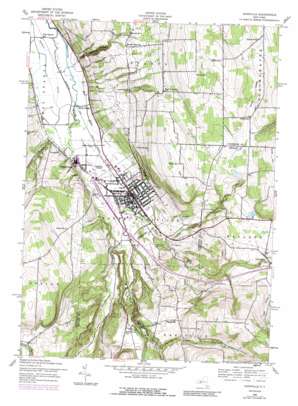
Dansville Topo Map New York
To zoom in, hover over the map of Dansville
USGS Topo Quad 42077e6 - 1:24,000 scale
| Topo Map Name: | Dansville |
| USGS Topo Quad ID: | 42077e6 |
| Print Size: | ca. 21 1/4" wide x 27" high |
| Southeast Coordinates: | 42.5° N latitude / 77.625° W longitude |
| Map Center Coordinates: | 42.5625° N latitude / 77.6875° W longitude |
| U.S. State: | NY |
| Filename: | o42077e6.jpg |
| Download Map JPG Image: | Dansville topo map 1:24,000 scale |
| Map Type: | Topographic |
| Topo Series: | 7.5´ |
| Map Scale: | 1:24,000 |
| Source of Map Images: | United States Geological Survey (USGS) |
| Alternate Map Versions: |
Dansville NY 1942, updated 1960 Download PDF Buy paper map Dansville NY 1942, updated 1960 Download PDF Buy paper map Dansville NY 1942, updated 1978 Download PDF Buy paper map Dansville NY 1942, updated 1989 Download PDF Buy paper map Dansville NY 2010 Download PDF Buy paper map Dansville NY 2013 Download PDF Buy paper map Dansville NY 2016 Download PDF Buy paper map |
1:24,000 Topo Quads surrounding Dansville
> Back to 42077e1 at 1:100,000 scale
> Back to 42076a1 at 1:250,000 scale
> Back to U.S. Topo Maps home
Dansville topo map: Gazetteer
Dansville: Airports
Dansville Municipal Airport elevation 196m 643′Dansville: Falls
Stone Falls elevation 286m 938′Dansville: Gaps
Pokamoonshine Hollow elevation 458m 1502′Dansville: Parks
Elm Park elevation 220m 721′Rotary Park elevation 205m 672′
Stony Brook State Park elevation 304m 997′
Washington Park elevation 210m 688′
Dansville: Populated Places
Cumminsville elevation 195m 639′Dansville elevation 215m 705′
Perkinsville elevation 416m 1364′
Reed Corners elevation 445m 1459′
Rogersville elevation 401m 1315′
Woodsville elevation 197m 646′
Dansville: Reservoirs
Dansville Reservoir elevation 284m 931′Dansville: Streams
Little Mill Creek elevation 240m 787′Mill Creek elevation 203m 666′
Mud Creek elevation 178m 583′
Stony Brook elevation 214m 702′
Dansville: Summits
East Hill elevation 513m 1683′Strong Hill elevation 573m 1879′
Dansville: Valleys
Carney Hollow elevation 463m 1519′Patterson Gully elevation 195m 639′
Sponable Gully elevation 356m 1167′
Whiteman Gully elevation 260m 853′
Dansville digital topo map on disk
Buy this Dansville topo map showing relief, roads, GPS coordinates and other geographical features, as a high-resolution digital map file on DVD:
New York, Vermont, Connecticut & Western Massachusetts
Buy digital topo maps: New York, Vermont, Connecticut & Western Massachusetts


