Penn Yan Topo Map New York
To zoom in, hover over the map of Penn Yan
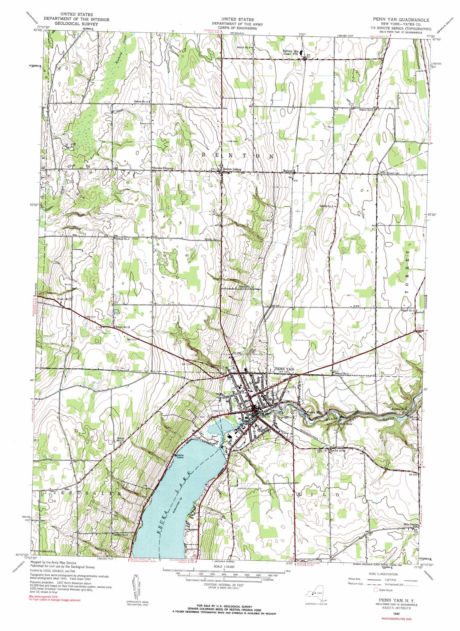
USGS Topo Quad 42077f1 - 1:24,000 scale
| Topo Map Name: | Penn Yan |
| USGS Topo Quad ID: | 42077f1 |
| Print Size: | ca. 21 1/4" wide x 27" high |
| Southeast Coordinates: | 42.625° N latitude / 77° W longitude |
| Map Center Coordinates: | 42.6875° N latitude / 77.0625° W longitude |
| U.S. State: | NY |
| Filename: | o42077f1.jpg |
| Download Map JPG Image: | Penn Yan topo map 1:24,000 scale |
| Map Type: | Topographic |
| Topo Series: | 7.5´ |
| Map Scale: | 1:24,000 |
| Source of Map Images: | United States Geological Survey (USGS) |
| Alternate Map Versions: |
Penn Yan NY 1942, updated 1960 Download PDF Buy paper map Penn Yan NY 1942, updated 1960 Download PDF Buy paper map Penn Yan NY 1942, updated 1990 Download PDF Buy paper map Penn Yan NY 2010 Download PDF Buy paper map Penn Yan NY 2013 Download PDF Buy paper map Penn Yan NY 2016 Download PDF Buy paper map |
1:24,000 Topo Quads surrounding Penn Yan
Canandaigua |
Clifton Springs |
Phelps |
Geneva North |
Seneca Falls |
Canandaigua Lake |
Rushville |
Stanley |
Geneva South |
Romulus |
Middlesex |
Potter |
Penn Yan |
Dresden |
Ovid |
Prattsburg |
Pulteney |
Keuka Park |
Dundee |
Lodi |
Rheims |
Hammondsport |
Wayne |
Reading Center |
Burdett |
> Back to 42077e1 at 1:100,000 scale
> Back to 42076a1 at 1:250,000 scale
> Back to U.S. Topo Maps home
Penn Yan topo map: Gazetteer
Penn Yan: Airports
Penn Yan Airport elevation 269m 882′Penn Yan: Populated Places
Benton elevation 255m 836′Benton Center elevation 335m 1099′
Havens Corner elevation 340m 1115′
Kenka Mills elevation 213m 698′
Milo Mills elevation 196m 643′
Penn Yan elevation 222m 728′
Seneca Mills elevation 208m 682′
Penn Yan: Streams
Jacobs Creek elevation 216m 708′Sucker Creek elevation 219m 718′
Penn Yan digital topo map on disk
Buy this Penn Yan topo map showing relief, roads, GPS coordinates and other geographical features, as a high-resolution digital map file on DVD:
New York, Vermont, Connecticut & Western Massachusetts
Buy digital topo maps: New York, Vermont, Connecticut & Western Massachusetts