Potter Topo Map New York
To zoom in, hover over the map of Potter
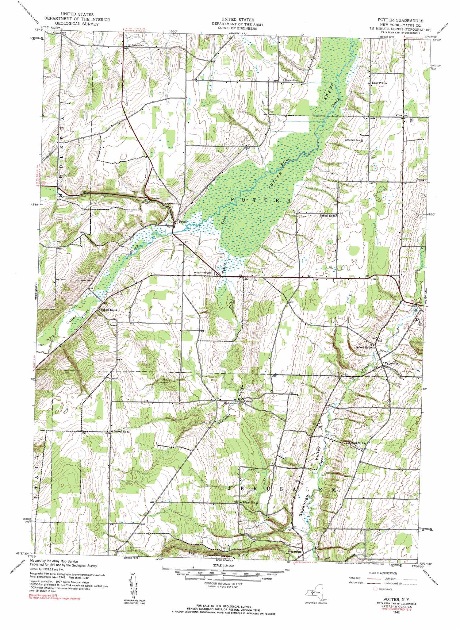
USGS Topo Quad 42077f2 - 1:24,000 scale
| Topo Map Name: | Potter |
| USGS Topo Quad ID: | 42077f2 |
| Print Size: | ca. 21 1/4" wide x 27" high |
| Southeast Coordinates: | 42.625° N latitude / 77.125° W longitude |
| Map Center Coordinates: | 42.6875° N latitude / 77.1875° W longitude |
| U.S. State: | NY |
| Filename: | o42077f2.jpg |
| Download Map JPG Image: | Potter topo map 1:24,000 scale |
| Map Type: | Topographic |
| Topo Series: | 7.5´ |
| Map Scale: | 1:24,000 |
| Source of Map Images: | United States Geological Survey (USGS) |
| Alternate Map Versions: |
Potter NY 1942, updated 1960 Download PDF Buy paper map Potter NY 1942, updated 1990 Download PDF Buy paper map Potter NY 2010 Download PDF Buy paper map Potter NY 2013 Download PDF Buy paper map Potter NY 2016 Download PDF Buy paper map |
1:24,000 Topo Quads surrounding Potter
Victor |
Canandaigua |
Clifton Springs |
Phelps |
Geneva North |
Bristol Center |
Canandaigua Lake |
Rushville |
Stanley |
Geneva South |
Bristol Springs |
Middlesex |
Potter |
Penn Yan |
Dresden |
Naples |
Prattsburg |
Pulteney |
Keuka Park |
Dundee |
Avoca |
Rheims |
Hammondsport |
Wayne |
Reading Center |
> Back to 42077e1 at 1:100,000 scale
> Back to 42076a1 at 1:250,000 scale
> Back to U.S. Topo Maps home
Potter topo map: Gazetteer
Potter: Populated Places
East Potter elevation 318m 1043′Friend elevation 303m 994′
Potter elevation 273m 895′
Voak elevation 357m 1171′
Yatesville elevation 269m 882′
Potter: Streams
Nettle Valley Creek elevation 271m 889′Potter: Swamps
Potter Swamp elevation 270m 885′Potter: Valleys
Big Gully elevation 232m 761′Italy Valley elevation 271m 889′
Sherman Hollow elevation 273m 895′
Potter digital topo map on disk
Buy this Potter topo map showing relief, roads, GPS coordinates and other geographical features, as a high-resolution digital map file on DVD:
New York, Vermont, Connecticut & Western Massachusetts
Buy digital topo maps: New York, Vermont, Connecticut & Western Massachusetts