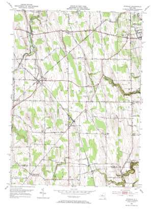
Stanley Topo Map New York
To zoom in, hover over the map of Stanley
USGS Topo Quad 42077g1 - 1:24,000 scale
| Topo Map Name: | Stanley |
| USGS Topo Quad ID: | 42077g1 |
| Print Size: | ca. 21 1/4" wide x 27" high |
| Southeast Coordinates: | 42.75° N latitude / 77° W longitude |
| Map Center Coordinates: | 42.8125° N latitude / 77.0625° W longitude |
| U.S. State: | NY |
| Filename: | o42077g1.jpg |
| Download Map JPG Image: | Stanley topo map 1:24,000 scale |
| Map Type: | Topographic |
| Topo Series: | 7.5´ |
| Map Scale: | 1:24,000 |
| Source of Map Images: | United States Geological Survey (USGS) |
| Alternate Map Versions: |
Stanley NY 1952, updated 1953 Download PDF Buy paper map Stanley NY 1952, updated 1970 Download PDF Buy paper map Stanley NY 2010 Download PDF Buy paper map Stanley NY 2013 Download PDF Buy paper map Stanley NY 2016 Download PDF Buy paper map |
1:24,000 Topo Quads surrounding Stanley
> Back to 42077e1 at 1:100,000 scale
> Back to 42076a1 at 1:250,000 scale
> Back to U.S. Topo Maps home
Stanley topo map: Gazetteer
Stanley: Airports
Hansen Farms Landing Strip elevation 273m 895′McBrides Airport elevation 276m 905′
Stape Field elevation 266m 872′
Stanley: Populated Places
Bellona elevation 221m 725′Billsboro Corners elevation 214m 702′
Flint elevation 249m 816′
Hall elevation 285m 935′
Lenox Park elevation 217m 711′
Stanley elevation 271m 889′
Stanley: Streams
Burrell Creek elevation 242m 793′Stanley: Summits
Crozier Hill elevation 266m 872′Locust Hill elevation 309m 1013′
Stanley digital topo map on disk
Buy this Stanley topo map showing relief, roads, GPS coordinates and other geographical features, as a high-resolution digital map file on DVD:
New York, Vermont, Connecticut & Western Massachusetts
Buy digital topo maps: New York, Vermont, Connecticut & Western Massachusetts


