Victor Topo Map New York
To zoom in, hover over the map of Victor
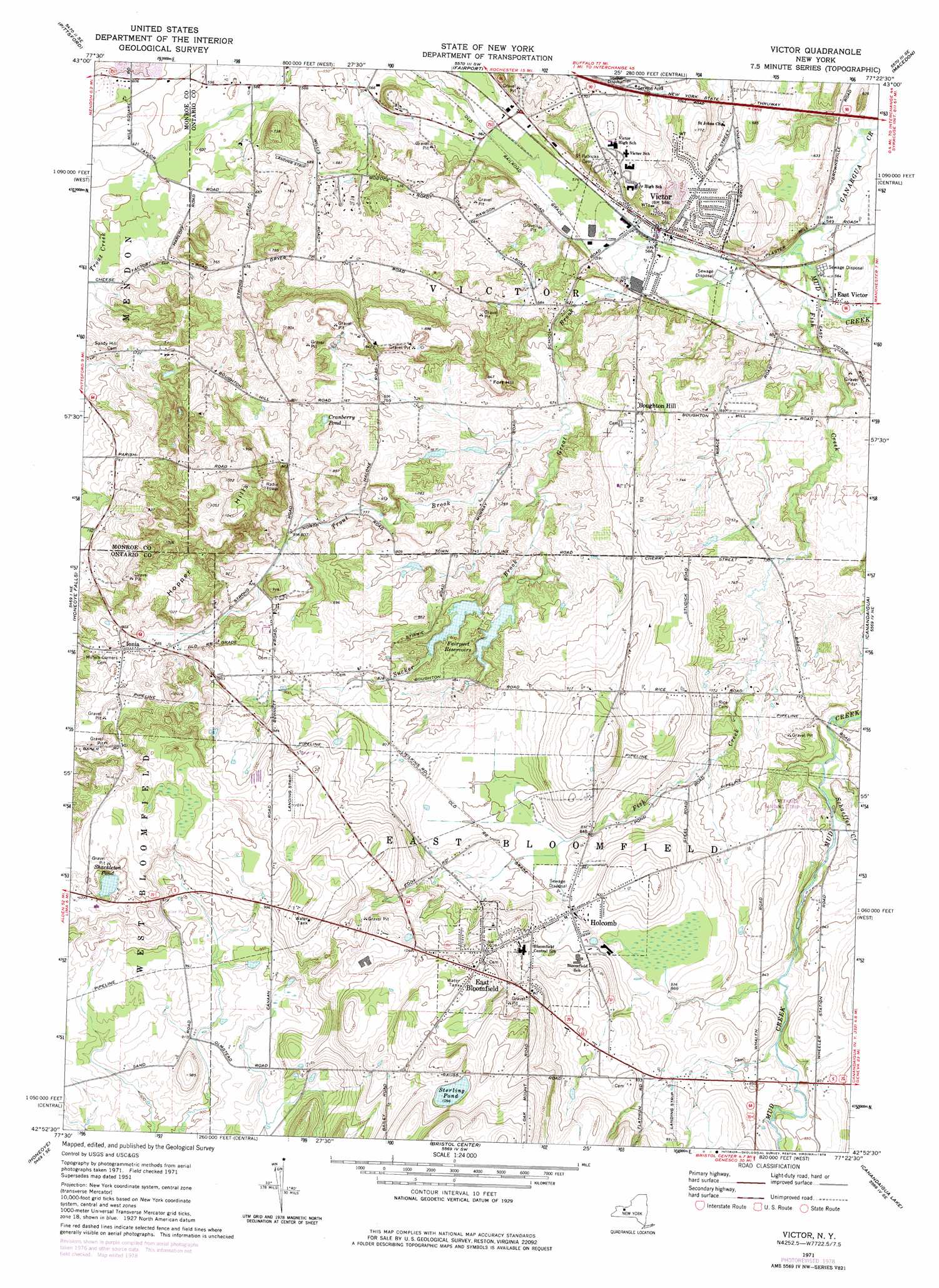
USGS Topo Quad 42077h4 - 1:24,000 scale
| Topo Map Name: | Victor |
| USGS Topo Quad ID: | 42077h4 |
| Print Size: | ca. 21 1/4" wide x 27" high |
| Southeast Coordinates: | 42.875° N latitude / 77.375° W longitude |
| Map Center Coordinates: | 42.9375° N latitude / 77.4375° W longitude |
| U.S. State: | NY |
| Filename: | o42077h4.jpg |
| Download Map JPG Image: | Victor topo map 1:24,000 scale |
| Map Type: | Topographic |
| Topo Series: | 7.5´ |
| Map Scale: | 1:24,000 |
| Source of Map Images: | United States Geological Survey (USGS) |
| Alternate Map Versions: |
Victor NY 1951, updated 1952 Download PDF Buy paper map Victor NY 1951, updated 1961 Download PDF Buy paper map Victor NY 1951, updated 1968 Download PDF Buy paper map Victor NY 1971, updated 1974 Download PDF Buy paper map Victor NY 1971, updated 1978 Download PDF Buy paper map Victor NY 1971, updated 1978 Download PDF Buy paper map Victor NY 2010 Download PDF Buy paper map Victor NY 2013 Download PDF Buy paper map Victor NY 2016 Download PDF Buy paper map |
1:24,000 Topo Quads surrounding Victor
Rochester West |
Rochester East |
Webster |
Ontario |
Williamson |
West Henrietta |
Pittsford |
Fairport |
Macedon |
Palmyra |
Rush |
Honeoye Falls |
Victor |
Canandaigua |
Clifton Springs |
Livonia |
Honeoye |
Bristol Center |
Canandaigua Lake |
Rushville |
Conesus |
Springwater |
Bristol Springs |
Middlesex |
Potter |
> Back to 42077e1 at 1:100,000 scale
> Back to 42076a1 at 1:250,000 scale
> Back to U.S. Topo Maps home
Victor topo map: Gazetteer
Victor: Airports
Creekside Airport elevation 240m 787′Weiss Airfield elevation 312m 1023′
Victor: Lakes
Cranberry Pond elevation 234m 767′Shackleton Pond elevation 297m 974′
Sterling Pond elevation 334m 1095′
Victor: Mines
Victor Quarry elevation 256m 839′Victor: Parks
Ganondagan State Historic Site elevation 216m 708′Victor: Populated Places
Boughton Hill elevation 248m 813′East Bloomfield elevation 326m 1069′
East Victor elevation 176m 577′
Holcomb elevation 267m 875′
Ionia elevation 271m 889′
Victor elevation 176m 577′
Victor: Reservoirs
Fairport Reservoirs elevation 238m 780′Victor: Streams
Fish Creek elevation 167m 547′Great Brook elevation 167m 547′
Mud Creek elevation 167m 547′
Schaeffer Creek elevation 227m 744′
Sucker Brook elevation 211m 692′
Trout Brook elevation 203m 666′
Victor: Summits
Fort Hill elevation 256m 839′Hopper Hills elevation 335m 1099′
Oak Mountain elevation 358m 1174′
Victor digital topo map on disk
Buy this Victor topo map showing relief, roads, GPS coordinates and other geographical features, as a high-resolution digital map file on DVD:
New York, Vermont, Connecticut & Western Massachusetts
Buy digital topo maps: New York, Vermont, Connecticut & Western Massachusetts