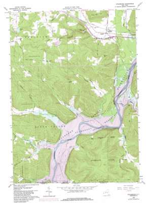
Steamburg Topo Map New York
To zoom in, hover over the map of Steamburg
USGS Topo Quad 42078a8 - 1:24,000 scale
| Topo Map Name: | Steamburg |
| USGS Topo Quad ID: | 42078a8 |
| Print Size: | ca. 21 1/4" wide x 27" high |
| Southeast Coordinates: | 42° N latitude / 78.875° W longitude |
| Map Center Coordinates: | 42.0625° N latitude / 78.9375° W longitude |
| U.S. State: | NY |
| Filename: | o42078a8.jpg |
| Download Map JPG Image: | Steamburg topo map 1:24,000 scale |
| Map Type: | Topographic |
| Topo Series: | 7.5´ |
| Map Scale: | 1:24,000 |
| Source of Map Images: | United States Geological Survey (USGS) |
| Alternate Map Versions: |
Steamburg NY 1962, updated 1964 Download PDF Buy paper map Steamburg NY 1962, updated 1971 Download PDF Buy paper map Steamburg NY 1962, updated 1980 Download PDF Buy paper map Steamburg NY 2010 Download PDF Buy paper map Steamburg NY 2013 Download PDF Buy paper map Steamburg NY 2016 Download PDF Buy paper map |
1:24,000 Topo Quads surrounding Steamburg
> Back to 42078a1 at 1:100,000 scale
> Back to 42078a1 at 1:250,000 scale
> Back to U.S. Topo Maps home
Steamburg topo map: Gazetteer
Steamburg: Airports
Coles Landing Airport elevation 422m 1384′Steamburg: Cliffs
High Peak elevation 412m 1351′Steamburg: Islands
Halliday Island elevation 397m 1302′Steamburg: Lakes
Pickup Lake elevation 584m 1916′Steamburg: Populated Places
Onoville elevation 401m 1315′Steamburg elevation 429m 1407′
Steamburg: Streams
Bone Run elevation 391m 1282′Browns Run elevation 400m 1312′
Holts Run elevation 402m 1318′
Hotchkiss Run elevation 393m 1289′
North Branch Sawmill Run elevation 424m 1391′
Peters Creek elevation 390m 1279′
Phillips Brook elevation 417m 1368′
Pierce Run elevation 393m 1289′
Pine Creek elevation 404m 1325′
Quaker Run elevation 395m 1295′
Sawmill Run elevation 389m 1276′
South Branch Sawmill Run elevation 424m 1391′
State Line Run elevation 405m 1328′
Wolf Run elevation 402m 1318′
Steamburg: Summits
Braley Hill elevation 653m 2142′Johnny Watt Hill elevation 563m 1847′
Pine Hill elevation 649m 2129′
Round Top elevation 635m 2083′
Steamburg: Valleys
Browns Hollow elevation 427m 1400′Hotchkiss Hollow elevation 418m 1371′
Steamburg digital topo map on disk
Buy this Steamburg topo map showing relief, roads, GPS coordinates and other geographical features, as a high-resolution digital map file on DVD:


