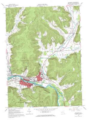
Salamanca Topo Map New York
To zoom in, hover over the map of Salamanca
USGS Topo Quad 42078b6 - 1:24,000 scale
| Topo Map Name: | Salamanca |
| USGS Topo Quad ID: | 42078b6 |
| Print Size: | ca. 21 1/4" wide x 27" high |
| Southeast Coordinates: | 42.125° N latitude / 78.625° W longitude |
| Map Center Coordinates: | 42.1875° N latitude / 78.6875° W longitude |
| U.S. State: | NY |
| Filename: | o42078b6.jpg |
| Download Map JPG Image: | Salamanca topo map 1:24,000 scale |
| Map Type: | Topographic |
| Topo Series: | 7.5´ |
| Map Scale: | 1:24,000 |
| Source of Map Images: | United States Geological Survey (USGS) |
| Alternate Map Versions: |
Salamanca NY 1961, updated 1963 Download PDF Buy paper map Salamanca NY 1961, updated 1971 Download PDF Buy paper map Salamanca NY 1961, updated 1971 Download PDF Buy paper map Salamanca NY 2010 Download PDF Buy paper map Salamanca NY 2013 Download PDF Buy paper map Salamanca NY 2016 Download PDF Buy paper map |
1:24,000 Topo Quads surrounding Salamanca
> Back to 42078a1 at 1:100,000 scale
> Back to 42078a1 at 1:250,000 scale
> Back to U.S. Topo Maps home
Salamanca topo map: Gazetteer
Salamanca: Airports
Great Valley Airport elevation 443m 1453′Salamanca: Islands
Palmers Island elevation 419m 1374′Salamanca: Populated Places
Great Valley elevation 445m 1459′Kill Buck elevation 429m 1407′
Little Rock City elevation 674m 2211′
Peth elevation 439m 1440′
Salamanca elevation 421m 1381′
Salamanca: Streams
Barker Run elevation 446m 1463′Forks Creek elevation 442m 1450′
Great Valley Creek elevation 414m 1358′
Hidden Creek elevation 464m 1522′
Little Valley Creek elevation 411m 1348′
Newton Run elevation 415m 1361′
Plum Brook elevation 444m 1456′
Porter Creek elevation 434m 1423′
Titus Run elevation 415m 1361′
Wrights Creek elevation 433m 1420′
Salamanca: Summits
Lindell Lookout elevation 707m 2319′Oyer Mountain elevation 647m 2122′
Smith Mountain elevation 678m 2224′
Salamanca: Valleys
Christian Hollow elevation 457m 1499′Field Hollow elevation 503m 1650′
Hungry Hollow elevation 437m 1433′
Mutton Hollow elevation 445m 1459′
Porter Hollow elevation 454m 1489′
Sullivan Hollow elevation 425m 1394′
Thorpe Hollow elevation 431m 1414′
Salamanca digital topo map on disk
Buy this Salamanca topo map showing relief, roads, GPS coordinates and other geographical features, as a high-resolution digital map file on DVD:


