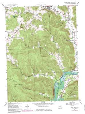
Little Valley Topo Map New York
To zoom in, hover over the map of Little Valley
USGS Topo Quad 42078b7 - 1:24,000 scale
| Topo Map Name: | Little Valley |
| USGS Topo Quad ID: | 42078b7 |
| Print Size: | ca. 21 1/4" wide x 27" high |
| Southeast Coordinates: | 42.125° N latitude / 78.75° W longitude |
| Map Center Coordinates: | 42.1875° N latitude / 78.8125° W longitude |
| U.S. State: | NY |
| Filename: | o42078b7.jpg |
| Download Map JPG Image: | Little Valley topo map 1:24,000 scale |
| Map Type: | Topographic |
| Topo Series: | 7.5´ |
| Map Scale: | 1:24,000 |
| Source of Map Images: | United States Geological Survey (USGS) |
| Alternate Map Versions: |
Little Valley NY 1962, updated 1964 Download PDF Buy paper map Little Valley NY 1962, updated 1976 Download PDF Buy paper map Little Valley NY 1962, updated 1980 Download PDF Buy paper map Little Valley NY 1962, updated 1980 Download PDF Buy paper map Little Valley NY 1962, updated 1980 Download PDF Buy paper map Little Valley NY 2010 Download PDF Buy paper map Little Valley NY 2013 Download PDF Buy paper map Little Valley NY 2016 Download PDF Buy paper map |
1:24,000 Topo Quads surrounding Little Valley
> Back to 42078a1 at 1:100,000 scale
> Back to 42078a1 at 1:250,000 scale
> Back to U.S. Topo Maps home
Little Valley topo map: Gazetteer
Little Valley: Bays
Newtons Eddy elevation 414m 1358′Little Valley: Flats
Hoags Flat elevation 415m 1361′Little Valley: Gaps
The Narrows elevation 579m 1899′Little Valley: Islands
Bucktooth Island elevation 412m 1351′Little Valley: Populated Places
Elkdale elevation 451m 1479′Shongo elevation 417m 1368′
Little Valley: Rapids
Bucktooth Rapids elevation 412m 1351′Little Valley: Streams
Breeds Run elevation 411m 1348′Bucktooth Run elevation 412m 1351′
Drakes Run elevation 414m 1358′
Dublin Creek elevation 454m 1489′
East Branch Bucktooth Run elevation 436m 1430′
Sawmill Run elevation 411m 1348′
West Branch Bucktooth Run elevation 436m 1430′
Whig Street Creek elevation 445m 1459′
Little Valley: Summits
Bucktooth Hill elevation 658m 2158′Jimmerson Hill elevation 675m 2214′
Parker Hill elevation 708m 2322′
Shutts Hill elevation 733m 2404′
Little Valley: Valleys
Bailey Hollow elevation 455m 1492′Dublin Hollow elevation 449m 1473′
Lees Hollow elevation 461m 1512′
Woodworth Hollow elevation 437m 1433′
Little Valley digital topo map on disk
Buy this Little Valley topo map showing relief, roads, GPS coordinates and other geographical features, as a high-resolution digital map file on DVD:


