Randolph Topo Map New York
To zoom in, hover over the map of Randolph
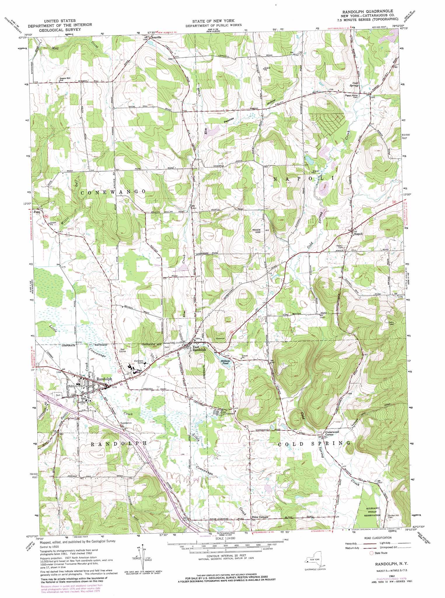
USGS Topo Quad 42078b8 - 1:24,000 scale
| Topo Map Name: | Randolph |
| USGS Topo Quad ID: | 42078b8 |
| Print Size: | ca. 21 1/4" wide x 27" high |
| Southeast Coordinates: | 42.125° N latitude / 78.875° W longitude |
| Map Center Coordinates: | 42.1875° N latitude / 78.9375° W longitude |
| U.S. State: | NY |
| Filename: | o42078b8.jpg |
| Download Map JPG Image: | Randolph topo map 1:24,000 scale |
| Map Type: | Topographic |
| Topo Series: | 7.5´ |
| Map Scale: | 1:24,000 |
| Source of Map Images: | United States Geological Survey (USGS) |
| Alternate Map Versions: |
Randolph NY 1962, updated 1964 Download PDF Buy paper map Randolph NY 1962, updated 1980 Download PDF Buy paper map Randolph NY 2010 Download PDF Buy paper map Randolph NY 2013 Download PDF Buy paper map Randolph NY 2016 Download PDF Buy paper map |
1:24,000 Topo Quads surrounding Randolph
Forestville |
Perrysburg |
Gowanda |
Collins Center |
Ashford Hollow |
Hamlet |
Cherry Creek |
New Albion |
Cattaraugus |
Ellicottville |
Gerry |
Kennedy |
Randolph |
Little Valley |
Salamanca |
Jamestown |
Ivory |
Steamburg |
Red House |
Limestone |
Russell |
Scandia |
Cornplanter Run |
Stickney |
Bradford |
> Back to 42078a1 at 1:100,000 scale
> Back to 42078a1 at 1:250,000 scale
> Back to U.S. Topo Maps home
Randolph topo map: Gazetteer
Randolph: Airports
Cowen's Flying Field (historical) elevation 399m 1309′Randolph: Lakes
Stillson Pond elevation 424m 1391′Randolph: Parks
Legion Park elevation 390m 1279′Randolph: Populated Places
Axeville elevation 511m 1676′East Randolph elevation 404m 1325′
Napoli elevation 528m 1732′
Randolph elevation 389m 1276′
Underwood Corner elevation 447m 1466′
Randolph: Reservoirs
East Randolph Reservoir elevation 469m 1538′Randolph: Springs
Cold Spring elevation 506m 1660′Randolph: Streams
Battle Creek elevation 388m 1272′Elm Creek elevation 389m 1276′
Randolph: Summits
Hoxie Hill elevation 572m 1876′Randolph: Valleys
Peaslee Hollow elevation 473m 1551′Willis Gulf elevation 396m 1299′
Randolph digital topo map on disk
Buy this Randolph topo map showing relief, roads, GPS coordinates and other geographical features, as a high-resolution digital map file on DVD:
 map DVD")