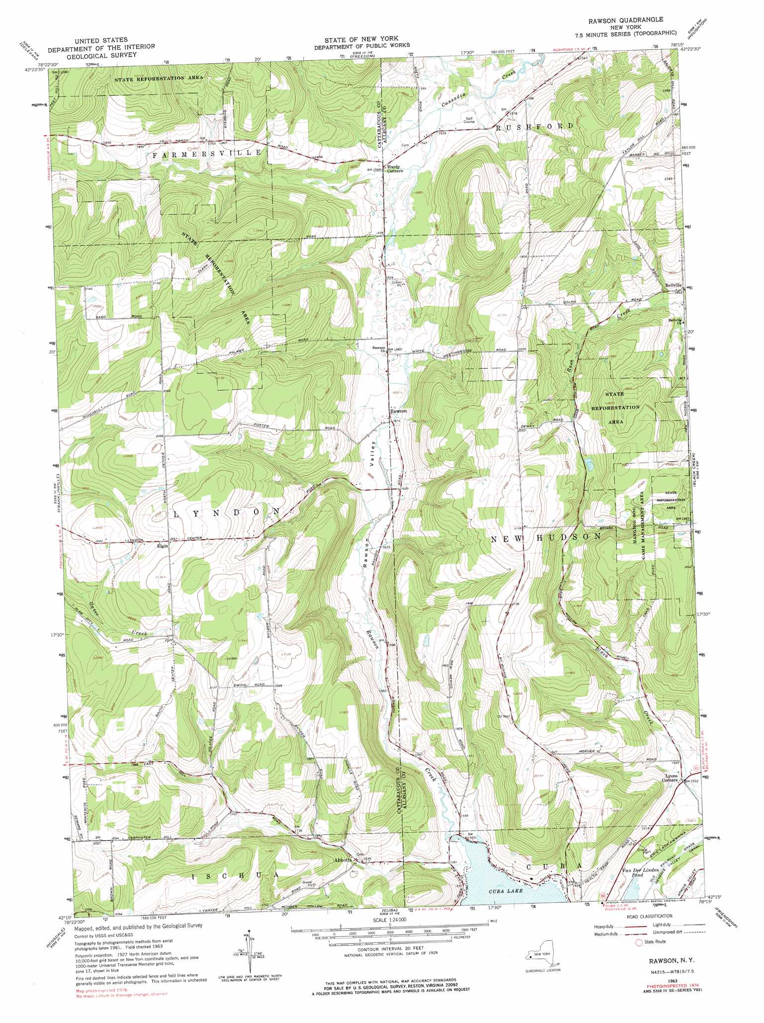
Rawson Topo Map New York
To zoom in, hover over the map of Rawson
USGS Topo Quad 42078c3 - 1:24,000 scale
| Topo Map Name: | Rawson |
| USGS Topo Quad ID: | 42078c3 |
| Print Size: | ca. 21 1/4" wide x 27" high |
| Southeast Coordinates: | 42.25° N latitude / 78.25° W longitude |
| Map Center Coordinates: | 42.3125° N latitude / 78.3125° W longitude |
| U.S. State: | NY |
| Filename: | o42078c3.jpg |
| Download Map JPG Image: | Rawson topo map 1:24,000 scale |
| Map Type: | Topographic |
| Topo Series: | 7.5´ |
| Map Scale: | 1:24,000 |
| Source of Map Images: | United States Geological Survey (USGS) |
| Alternate Map Versions: |
Rawson NY 1963, updated 1964 Download PDF Buy paper map Rawson NY 1963, updated 1978 Download PDF Buy paper map Rawson NY 2010 Download PDF Buy paper map Rawson NY 2013 Download PDF Buy paper map Rawson NY 2016 Download PDF Buy paper map |
1:24,000 Topo Quads surrounding Rawson
Sardinia |
Arcade |
Bliss |
Pike |
Portageville |
West Valley |
Delevan |
Freedom |
Houghton |
Fillmore |
Ashford |
Franklinville |
Rawson |
Black Creek |
Angelica |
Humphrey |
Hinsdale |
Cuba |
Friendship |
Belmont |
Knapp Creek |
Olean |
Portville |
Bolivar |
Allentown |
> Back to 42078a1 at 1:100,000 scale
> Back to 42078a1 at 1:250,000 scale
> Back to U.S. Topo Maps home
Rawson topo map: Gazetteer
Rawson: Populated Places
Abbotts elevation 498m 1633′Bellville elevation 520m 1706′
Hardy Corners elevation 476m 1561′
Lyndon elevation 629m 2063′
Lyons Corners elevation 465m 1525′
Rawson elevation 492m 1614′
Rawson: Streams
Rawson Creek elevation 471m 1545′Rawson: Valleys
Rawson Valley elevation 475m 1558′Rawson digital topo map on disk
Buy this Rawson topo map showing relief, roads, GPS coordinates and other geographical features, as a high-resolution digital map file on DVD:
 map DVD")