New Albion Topo Map New York
To zoom in, hover over the map of New Albion
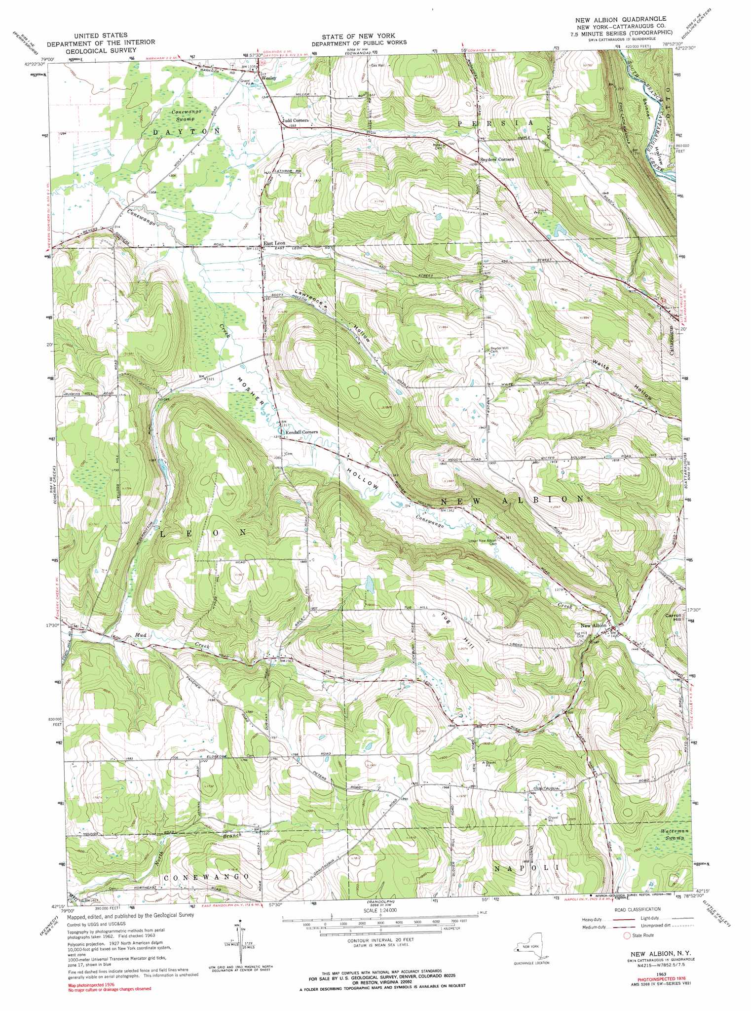
USGS Topo Quad 42078c8 - 1:24,000 scale
| Topo Map Name: | New Albion |
| USGS Topo Quad ID: | 42078c8 |
| Print Size: | ca. 21 1/4" wide x 27" high |
| Southeast Coordinates: | 42.25° N latitude / 78.875° W longitude |
| Map Center Coordinates: | 42.3125° N latitude / 78.9375° W longitude |
| U.S. State: | NY |
| Filename: | o42078c8.jpg |
| Download Map JPG Image: | New Albion topo map 1:24,000 scale |
| Map Type: | Topographic |
| Topo Series: | 7.5´ |
| Map Scale: | 1:24,000 |
| Source of Map Images: | United States Geological Survey (USGS) |
| Alternate Map Versions: |
New Albion NY 1963, updated 1964 Download PDF Buy paper map New Albion NY 1963, updated 1990 Download PDF Buy paper map New Albion NY 2010 Download PDF Buy paper map New Albion NY 2013 Download PDF Buy paper map New Albion NY 2016 Download PDF Buy paper map |
1:24,000 Topo Quads surrounding New Albion
Silver Creek |
Farnham |
North Collins |
Langford |
Springville |
Forestville |
Perrysburg |
Gowanda |
Collins Center |
Ashford Hollow |
Hamlet |
Cherry Creek |
New Albion |
Cattaraugus |
Ellicottville |
Gerry |
Kennedy |
Randolph |
Little Valley |
Salamanca |
Jamestown |
Ivory |
Steamburg |
Red House |
Limestone |
> Back to 42078a1 at 1:100,000 scale
> Back to 42078a1 at 1:250,000 scale
> Back to U.S. Topo Maps home
New Albion topo map: Gazetteer
New Albion: Populated Places
East Leon elevation 408m 1338′New Albion elevation 432m 1417′
Snyders Corners elevation 467m 1532′
Wesley elevation 402m 1318′
New Albion: Streams
North Branch Mill Creek elevation 438m 1437′New Albion: Summits
Tug Hill elevation 630m 2066′New Albion: Swamps
Conewango Swamp elevation 398m 1305′Waterman Swamp elevation 522m 1712′
New Albion: Valleys
Lawrence Hollow elevation 408m 1338′Mosher Hollow elevation 400m 1312′
New Albion digital topo map on disk
Buy this New Albion topo map showing relief, roads, GPS coordinates and other geographical features, as a high-resolution digital map file on DVD:
 map DVD")