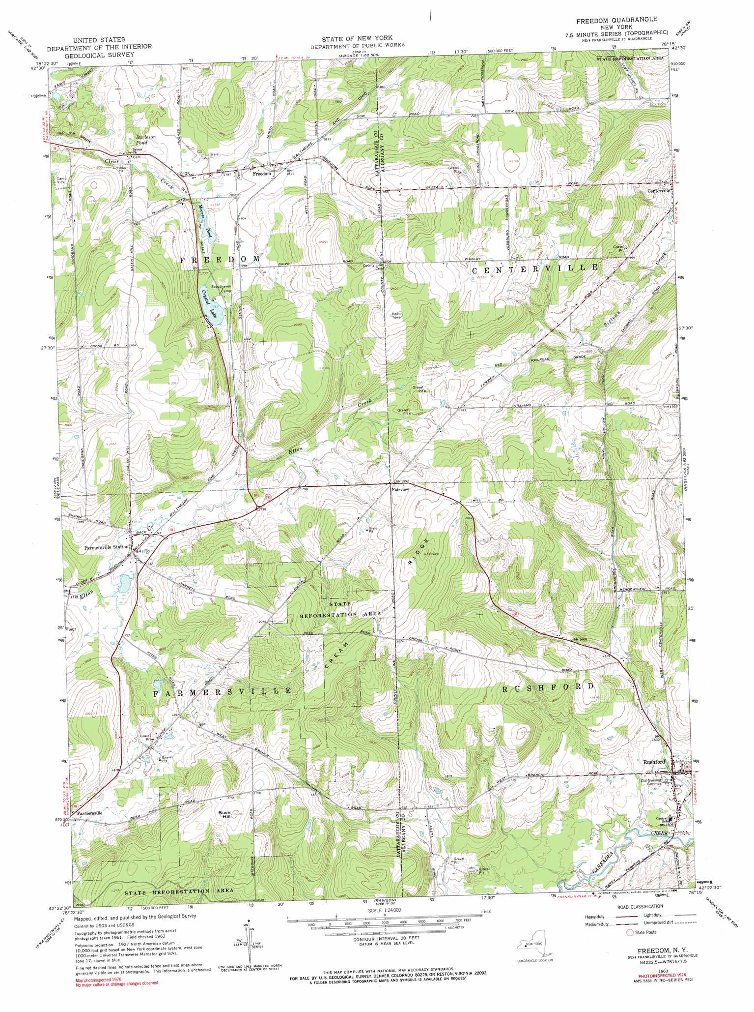
Freedom Topo Map New York
To zoom in, hover over the map of Freedom
USGS Topo Quad 42078d3 - 1:24,000 scale
| Topo Map Name: | Freedom |
| USGS Topo Quad ID: | 42078d3 |
| Print Size: | ca. 21 1/4" wide x 27" high |
| Southeast Coordinates: | 42.375° N latitude / 78.25° W longitude |
| Map Center Coordinates: | 42.4375° N latitude / 78.3125° W longitude |
| U.S. State: | NY |
| Filename: | o42078d3.jpg |
| Download Map JPG Image: | Freedom topo map 1:24,000 scale |
| Map Type: | Topographic |
| Topo Series: | 7.5´ |
| Map Scale: | 1:24,000 |
| Source of Map Images: | United States Geological Survey (USGS) |
| Alternate Map Versions: |
Freedom NY 1963, updated 1964 Download PDF Buy paper map Freedom NY 1963, updated 1990 Download PDF Buy paper map Freedom NY 1963, updated 1990 Download PDF Buy paper map Freedom NY 2010 Download PDF Buy paper map Freedom NY 2013 Download PDF Buy paper map Freedom NY 2016 Download PDF Buy paper map |
1:24,000 Topo Quads surrounding Freedom
Holland |
Strykersville |
Johnsonburg |
Warsaw |
Castile |
Sardinia |
Arcade |
Bliss |
Pike |
Portageville |
West Valley |
Delevan |
Freedom |
Houghton |
Fillmore |
Ashford |
Franklinville |
Rawson |
Black Creek |
Angelica |
Humphrey |
Hinsdale |
Cuba |
Friendship |
Belmont |
> Back to 42078a1 at 1:100,000 scale
> Back to 42078a1 at 1:250,000 scale
> Back to U.S. Topo Maps home
Freedom topo map: Gazetteer
Freedom: Lakes
Crystal Lake elevation 537m 1761′Moores Pond elevation 535m 1755′
Freedom: Populated Places
Fairview elevation 607m 1991′Farmersville Station elevation 525m 1722′
Freedom elevation 549m 1801′
Rushford elevation 457m 1499′
Freedom: Ridges
Cream Ridge elevation 667m 2188′Freedom: Summits
Bush Hill elevation 671m 2201′Freedom: Swamps
Burleson Pond elevation 527m 1729′Freedom digital topo map on disk
Buy this Freedom topo map showing relief, roads, GPS coordinates and other geographical features, as a high-resolution digital map file on DVD:
 map DVD")