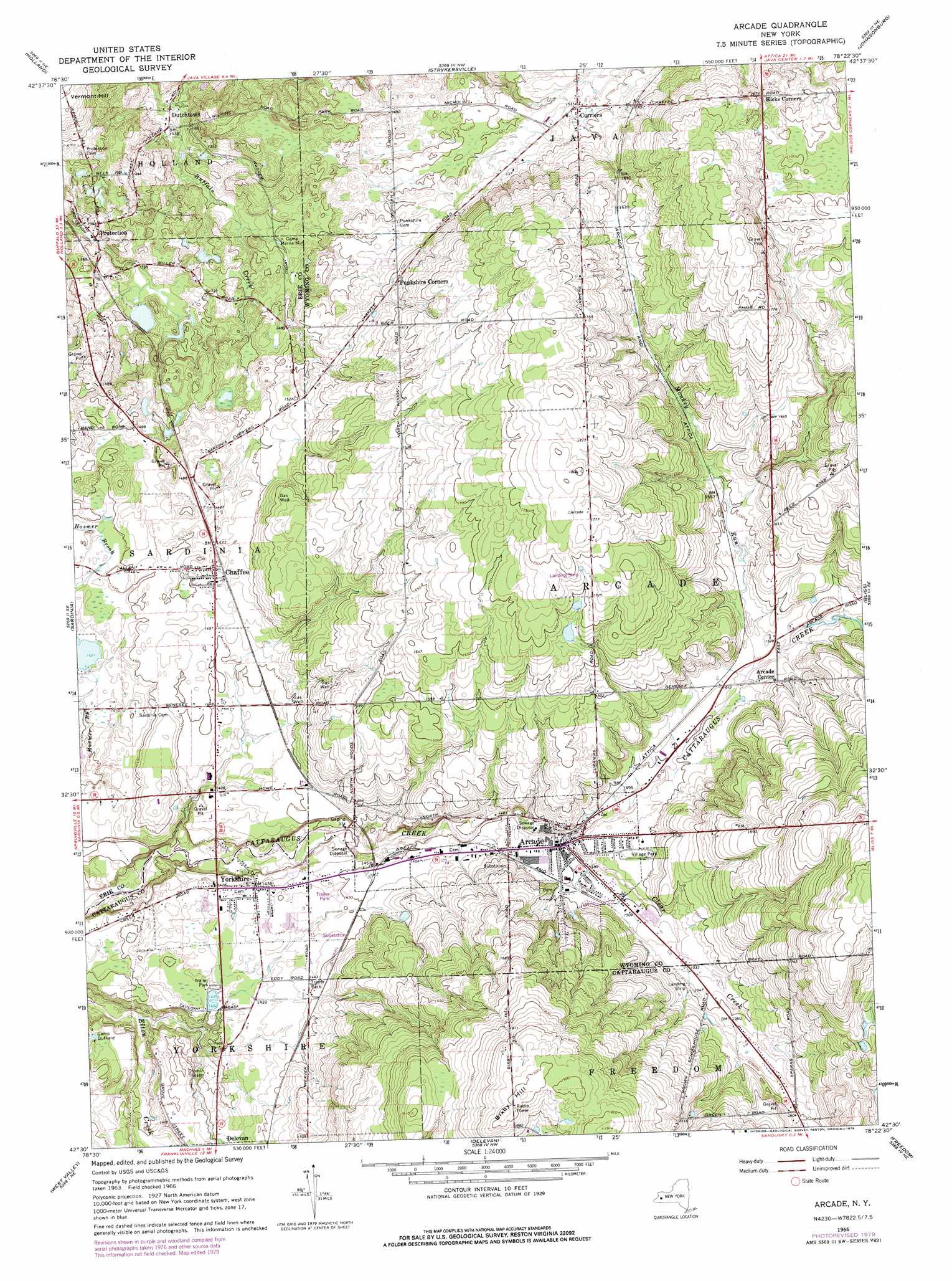
Arcade Topo Map New York
To zoom in, hover over the map of Arcade
USGS Topo Quad 42078e4 - 1:24,000 scale
| Topo Map Name: | Arcade |
| USGS Topo Quad ID: | 42078e4 |
| Print Size: | ca. 21 1/4" wide x 27" high |
| Southeast Coordinates: | 42.5° N latitude / 78.375° W longitude |
| Map Center Coordinates: | 42.5625° N latitude / 78.4375° W longitude |
| U.S. State: | NY |
| Filename: | o42078e4.jpg |
| Download Map JPG Image: | Arcade topo map 1:24,000 scale |
| Map Type: | Topographic |
| Topo Series: | 7.5´ |
| Map Scale: | 1:24,000 |
| Source of Map Images: | United States Geological Survey (USGS) |
| Alternate Map Versions: |
Arcade NY 1966, updated 1968 Download PDF Buy paper map Arcade NY 1966, updated 1979 Download PDF Buy paper map Arcade NY 2010 Download PDF Buy paper map Arcade NY 2013 Download PDF Buy paper map Arcade NY 2016 Download PDF Buy paper map |
1:24,000 Topo Quads surrounding Arcade
Orchard Park |
East Aurora |
Cowlesville |
Attica |
Dale |
Colden |
Holland |
Strykersville |
Johnsonburg |
Warsaw |
Springville |
Sardinia |
Arcade |
Bliss |
Pike |
Ashford Hollow |
West Valley |
Delevan |
Freedom |
Houghton |
Ellicottville |
Ashford |
Franklinville |
Rawson |
Black Creek |
> Back to 42078e1 at 1:100,000 scale
> Back to 42078a1 at 1:250,000 scale
> Back to U.S. Topo Maps home
Arcade topo map: Gazetteer
Arcade: Airports
Arcade Airpark elevation 532m 1745′Arcade: Mines
Chaffee Gravel Pit elevation 451m 1479′Arcade: Populated Places
Arcade elevation 450m 1476′Chaffee elevation 445m 1459′
Curriers elevation 467m 1532′
Dutchtown elevation 408m 1338′
Protection elevation 416m 1364′
Punkshire Corners elevation 478m 1568′
Yorkshire elevation 437m 1433′
Arcade: Streams
Clear Creek elevation 447m 1466′Monkey Run elevation 460m 1509′
Arcade: Summits
Bixby Hill elevation 582m 1909′Arcade digital topo map on disk
Buy this Arcade topo map showing relief, roads, GPS coordinates and other geographical features, as a high-resolution digital map file on DVD:
 map DVD")