Langford Topo Map New York
To zoom in, hover over the map of Langford
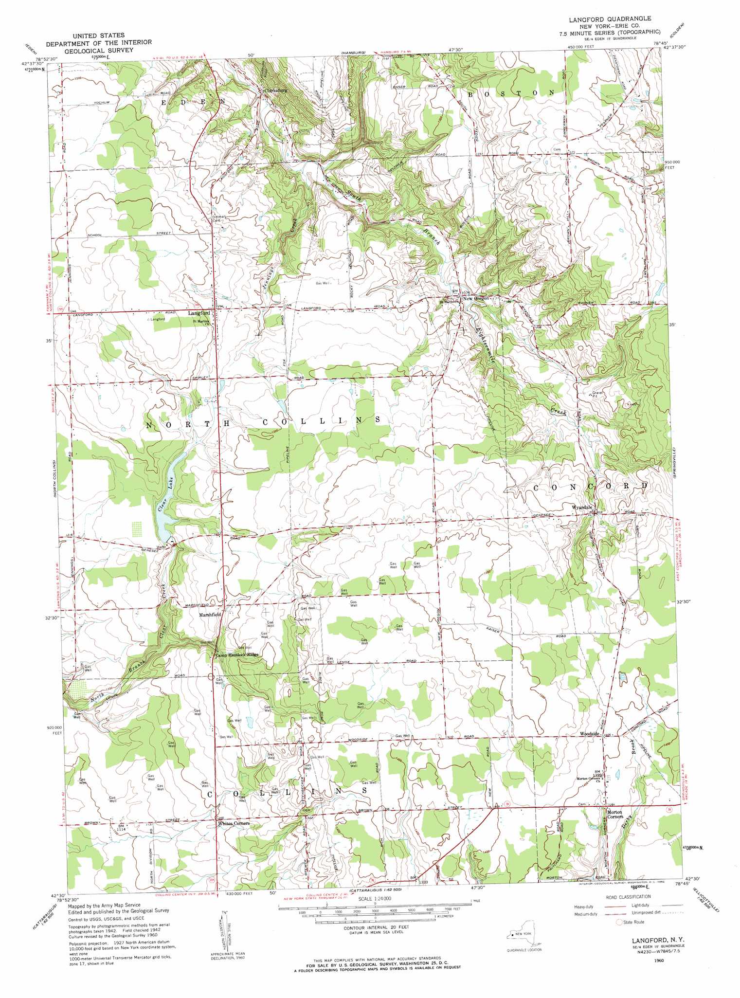
USGS Topo Quad 42078e7 - 1:24,000 scale
| Topo Map Name: | Langford |
| USGS Topo Quad ID: | 42078e7 |
| Print Size: | ca. 21 1/4" wide x 27" high |
| Southeast Coordinates: | 42.5° N latitude / 78.75° W longitude |
| Map Center Coordinates: | 42.5625° N latitude / 78.8125° W longitude |
| U.S. State: | NY |
| Filename: | o42078e7.jpg |
| Download Map JPG Image: | Langford topo map 1:24,000 scale |
| Map Type: | Topographic |
| Topo Series: | 7.5´ |
| Map Scale: | 1:24,000 |
| Source of Map Images: | United States Geological Survey (USGS) |
| Alternate Map Versions: |
Langford NY 1960, updated 1962 Download PDF Buy paper map Langford NY 1960, updated 1962 Download PDF Buy paper map Langford NY 2010 Download PDF Buy paper map Langford NY 2013 Download PDF Buy paper map Langford NY 2016 Download PDF Buy paper map |
1:24,000 Topo Quads surrounding Langford
Buffalo Se |
Orchard Park |
East Aurora |
||
Angola |
Eden |
Hamburg |
Colden |
Holland |
Farnham |
North Collins |
Langford |
Springville |
Sardinia |
Perrysburg |
Gowanda |
Collins Center |
Ashford Hollow |
West Valley |
Cherry Creek |
New Albion |
Cattaraugus |
Ellicottville |
Ashford |
> Back to 42078e1 at 1:100,000 scale
> Back to 42078a1 at 1:250,000 scale
> Back to U.S. Topo Maps home
Langford topo map: Gazetteer
Langford: Populated Places
Clarksburg elevation 272m 892′Langford elevation 392m 1286′
Marshfield elevation 391m 1282′
Morton Corners elevation 421m 1381′
New Oregon elevation 327m 1072′
Woodside elevation 431m 1414′
Wyandale elevation 396m 1299′
Langford: Reservoirs
Clear Lake elevation 366m 1200′Langford: Streams
Jennings Creek elevation 284m 931′Langford digital topo map on disk
Buy this Langford topo map showing relief, roads, GPS coordinates and other geographical features, as a high-resolution digital map file on DVD:
 map DVD")