North Collins Topo Map New York
To zoom in, hover over the map of North Collins
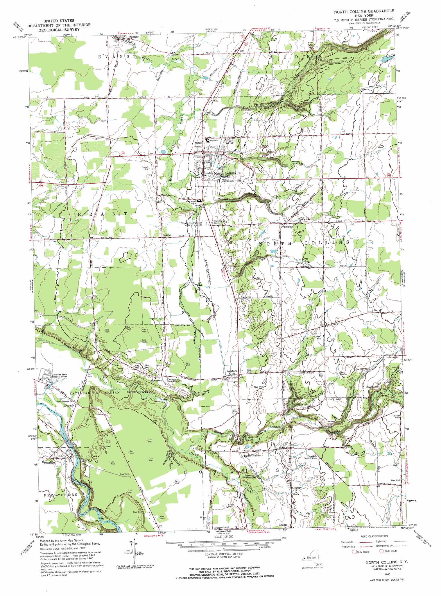
USGS Topo Quad 42078e8 - 1:24,000 scale
| Topo Map Name: | North Collins |
| USGS Topo Quad ID: | 42078e8 |
| Print Size: | ca. 21 1/4" wide x 27" high |
| Southeast Coordinates: | 42.5° N latitude / 78.875° W longitude |
| Map Center Coordinates: | 42.5625° N latitude / 78.9375° W longitude |
| U.S. State: | NY |
| Filename: | o42078e8.jpg |
| Download Map JPG Image: | North Collins topo map 1:24,000 scale |
| Map Type: | Topographic |
| Topo Series: | 7.5´ |
| Map Scale: | 1:24,000 |
| Source of Map Images: | United States Geological Survey (USGS) |
| Alternate Map Versions: |
North Collins NY 1960, updated 1962 Download PDF Buy paper map North Collins NY 1960, updated 1973 Download PDF Buy paper map North Collins NY 2010 Download PDF Buy paper map North Collins NY 2013 Download PDF Buy paper map North Collins NY 2016 Download PDF Buy paper map |
1:24,000 Topo Quads surrounding North Collins
Buffalo Se |
Orchard Park |
|||
Angola |
Eden |
Hamburg |
Colden |
|
Silver Creek |
Farnham |
North Collins |
Langford |
Springville |
Forestville |
Perrysburg |
Gowanda |
Collins Center |
Ashford Hollow |
Hamlet |
Cherry Creek |
New Albion |
Cattaraugus |
Ellicottville |
> Back to 42078e1 at 1:100,000 scale
> Back to 42078a1 at 1:250,000 scale
> Back to U.S. Topo Maps home
North Collins topo map: Gazetteer
North Collins: Airports
Gibraltar Heliport elevation 294m 964′Gowanda Airport elevation 253m 830′
Gowanda Airport (historical) elevation 254m 833′
North Collins: Populated Places
Fenton elevation 242m 793′Iroquois elevation 204m 669′
Lawtons elevation 259m 849′
Newtown elevation 260m 853′
North Collins elevation 252m 826′
Pontiac elevation 217m 711′
Shirley elevation 323m 1059′
Taylor Hollow elevation 264m 866′
Versailles elevation 233m 764′
North Collins: Streams
Little Indian Creek elevation 193m 633′North Branch Clear Creek elevation 223m 731′
North Collins: Valleys
Franklin Gulf elevation 243m 797′Hussey Gulf elevation 241m 790′
North Collins digital topo map on disk
Buy this North Collins topo map showing relief, roads, GPS coordinates and other geographical features, as a high-resolution digital map file on DVD:
 map DVD")