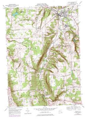
Attica Topo Map New York
To zoom in, hover over the map of Attica
USGS Topo Quad 42078g3 - 1:24,000 scale
| Topo Map Name: | Attica |
| USGS Topo Quad ID: | 42078g3 |
| Print Size: | ca. 21 1/4" wide x 27" high |
| Southeast Coordinates: | 42.75° N latitude / 78.25° W longitude |
| Map Center Coordinates: | 42.8125° N latitude / 78.3125° W longitude |
| U.S. State: | NY |
| Filename: | o42078g3.jpg |
| Download Map JPG Image: | Attica topo map 1:24,000 scale |
| Map Type: | Topographic |
| Topo Series: | 7.5´ |
| Map Scale: | 1:24,000 |
| Source of Map Images: | United States Geological Survey (USGS) |
| Alternate Map Versions: |
Attica NY 1949, updated 1969 Download PDF Buy paper map Attica NY 1949, updated 1978 Download PDF Buy paper map Attica NY 1951 Download PDF Buy paper map Attica NY 2010 Download PDF Buy paper map Attica NY 2013 Download PDF Buy paper map Attica NY 2016 Download PDF Buy paper map |
1:24,000 Topo Quads surrounding Attica
> Back to 42078e1 at 1:100,000 scale
> Back to 42078a1 at 1:250,000 scale
> Back to U.S. Topo Maps home
Attica topo map: Gazetteer
Attica: Falls
Johnson Falls elevation 374m 1227′Attica: Gaps
Konawaugus Valley elevation 408m 1338′Attica: Populated Places
Attica elevation 299m 980′Danley Corners elevation 412m 1351′
Dutch Flats elevation 455m 1492′
East Bennington elevation 408m 1338′
Sierks elevation 302m 990′
South Attica elevation 448m 1469′
Varysburg elevation 353m 1158′
Attica: Reservoirs
Akron Reservoir elevation 371m 1217′Attica Reservoir elevation 354m 1161′
Stevens Reservoir elevation 363m 1190′
Attica: Streams
Crow Creek elevation 294m 964′Johnson Creek elevation 320m 1049′
Stony Brook elevation 334m 1095′
Tunnery Brook elevation 291m 954′
Attica: Summits
Cobble Hill elevation 515m 1689′Orr Hill elevation 497m 1630′
Poland Hill elevation 465m 1525′
Attica: Valleys
Stony Brook Glen elevation 351m 1151′Attica digital topo map on disk
Buy this Attica topo map showing relief, roads, GPS coordinates and other geographical features, as a high-resolution digital map file on DVD:


