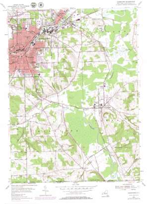
Jamestown Topo Map New York
To zoom in, hover over the map of Jamestown
USGS Topo Quad 42079a2 - 1:24,000 scale
| Topo Map Name: | Jamestown |
| USGS Topo Quad ID: | 42079a2 |
| Print Size: | ca. 21 1/4" wide x 27" high |
| Southeast Coordinates: | 42° N latitude / 79.125° W longitude |
| Map Center Coordinates: | 42.0625° N latitude / 79.1875° W longitude |
| U.S. State: | NY |
| Filename: | o42079a2.jpg |
| Download Map JPG Image: | Jamestown topo map 1:24,000 scale |
| Map Type: | Topographic |
| Topo Series: | 7.5´ |
| Map Scale: | 1:24,000 |
| Source of Map Images: | United States Geological Survey (USGS) |
| Alternate Map Versions: |
Jamestown NY 1954, updated 1956 Download PDF Buy paper map Jamestown NY 1954, updated 1965 Download PDF Buy paper map Jamestown NY 1954, updated 1980 Download PDF Buy paper map Jamestown NY 1979, updated 1980 Download PDF Buy paper map Jamestown NY 2010 Download PDF Buy paper map Jamestown NY 2013 Download PDF Buy paper map Jamestown NY 2016 Download PDF Buy paper map |
1:24,000 Topo Quads surrounding Jamestown
> Back to 42079a1 at 1:100,000 scale
> Back to 42078a1 at 1:250,000 scale
> Back to U.S. Topo Maps home
Jamestown topo map: Gazetteer
Jamestown: Airports
Laska Airport elevation 433m 1420′WCA Hospital Heliport elevation 408m 1338′
Jamestown: Lakes
Clay Pond elevation 381m 1250′Jamestown: Parks
Allen Park elevation 458m 1502′Baker Park elevation 427m 1400′
Dow Park elevation 422m 1384′
Emory Park elevation 436m 1430′
Falconer Park elevation 387m 1269′
Fenton Park elevation 409m 1341′
Lincoln Park elevation 469m 1538′
Roseland Park elevation 409m 1341′
School Park elevation 398m 1305′
Willard Park elevation 487m 1597′
Jamestown: Populated Places
Falconer elevation 385m 1263′Falconer Mobile Home Park elevation 383m 1256′
Fentonville elevation 384m 1259′
Frewsburg elevation 396m 1299′
Jamestown elevation 420m 1377′
Kiantone elevation 459m 1505′
Stillwater elevation 389m 1276′
Jamestown: Streams
Cass Run elevation 375m 1230′Cassadaga Creek elevation 372m 1220′
Frews Run elevation 378m 1240′
Kiantone Creek elevation 373m 1223′
Moon Brook elevation 377m 1236′
Stillwater Creek elevation 372m 1220′
York Run elevation 385m 1263′
Jamestown: Summits
Jones Hill elevation 438m 1437′Jamestown: Swamps
Hartson Swamp elevation 380m 1246′Jamestown digital topo map on disk
Buy this Jamestown topo map showing relief, roads, GPS coordinates and other geographical features, as a high-resolution digital map file on DVD:


