North Clymer Topo Map New York
To zoom in, hover over the map of North Clymer
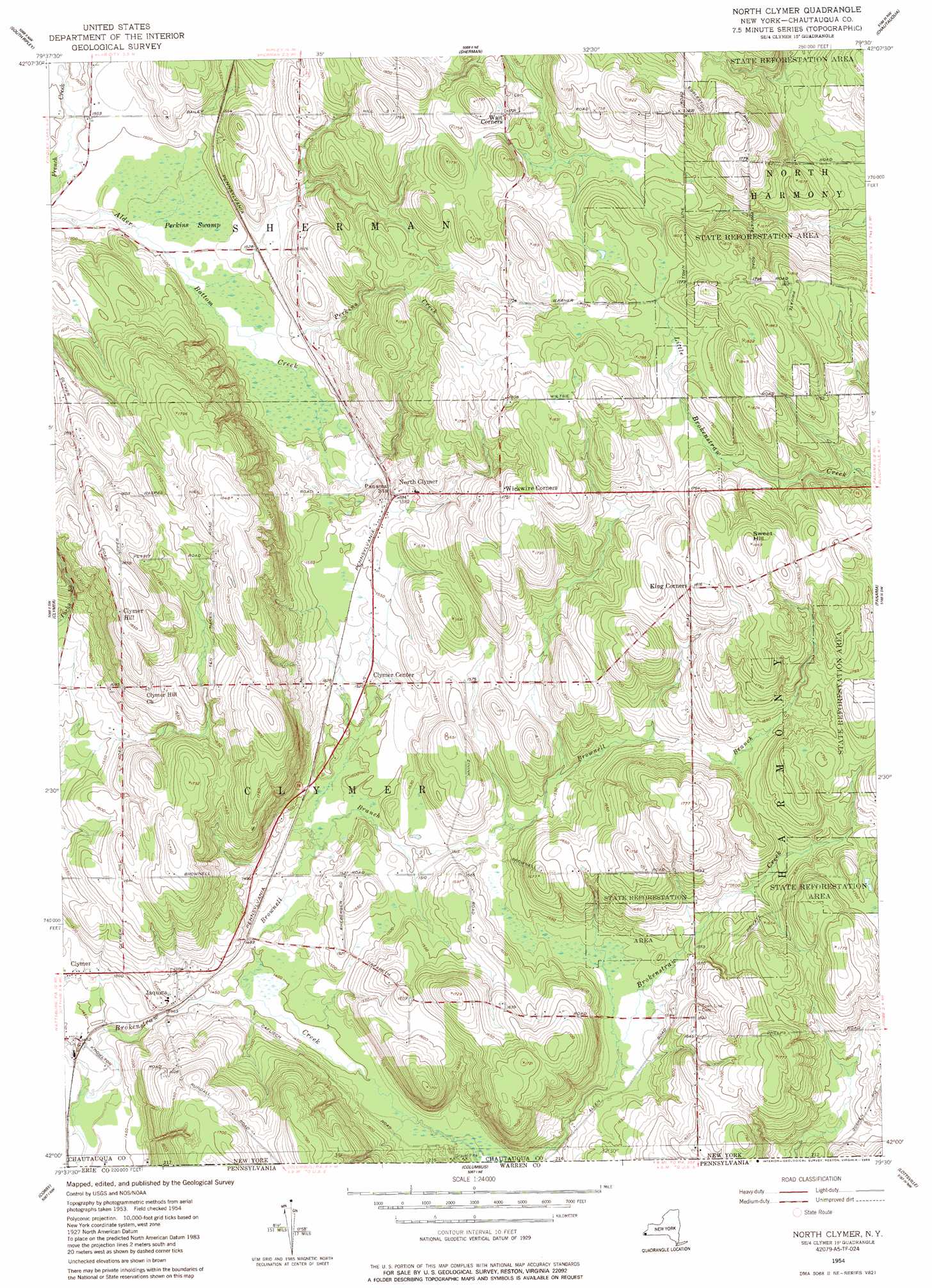
USGS Topo Quad 42079a5 - 1:24,000 scale
| Topo Map Name: | North Clymer |
| USGS Topo Quad ID: | 42079a5 |
| Print Size: | ca. 21 1/4" wide x 27" high |
| Southeast Coordinates: | 42° N latitude / 79.5° W longitude |
| Map Center Coordinates: | 42.0625° N latitude / 79.5625° W longitude |
| U.S. State: | NY |
| Filename: | o42079a5.jpg |
| Download Map JPG Image: | North Clymer topo map 1:24,000 scale |
| Map Type: | Topographic |
| Topo Series: | 7.5´ |
| Map Scale: | 1:24,000 |
| Source of Map Images: | United States Geological Survey (USGS) |
| Alternate Map Versions: |
North Clymer NY 1954, updated 1957 Download PDF Buy paper map North Clymer NY 1954, updated 1985 Download PDF Buy paper map North Clymer NY 1954, updated 1985 Download PDF Buy paper map North Clymer NY 2010 Download PDF Buy paper map North Clymer NY 2013 Download PDF Buy paper map North Clymer NY 2016 Download PDF Buy paper map |
1:24,000 Topo Quads surrounding North Clymer
Ripley |
Westfield |
Hartfield |
Cassadaga |
|
North East |
South Ripley |
Sherman |
Chautauqua |
Ellery Center |
Wattsburg |
Clymer |
North Clymer |
Panama |
Lakewood |
Union City |
Corry |
Columbus |
Lottsville |
Sugar Grove |
Lake Canadohta |
Spartansburg |
Spring Creek |
Pittsfield |
Youngsville |
> Back to 42079a1 at 1:100,000 scale
> Back to 42078a1 at 1:250,000 scale
> Back to U.S. Topo Maps home
North Clymer topo map: Gazetteer
North Clymer: Populated Places
Clymer Center elevation 463m 1519′Clymer Hill elevation 559m 1833′
Jaquins elevation 450m 1476′
North Clymer elevation 482m 1581′
North Clymer: Streams
Brownell Branch elevation 441m 1446′Perkins Creek elevation 452m 1482′
North Clymer: Summits
Sweet Hill elevation 569m 1866′North Clymer: Swamps
Perkins Swamp elevation 454m 1489′North Clymer digital topo map on disk
Buy this North Clymer topo map showing relief, roads, GPS coordinates and other geographical features, as a high-resolution digital map file on DVD:
 map DVD")