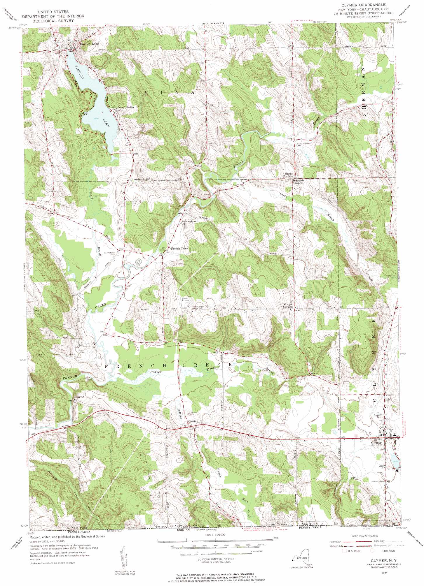
Clymer Topo Map New York
To zoom in, hover over the map of Clymer
USGS Topo Quad 42079a6 - 1:24,000 scale
| Topo Map Name: | Clymer |
| USGS Topo Quad ID: | 42079a6 |
| Print Size: | ca. 21 1/4" wide x 27" high |
| Southeast Coordinates: | 42° N latitude / 79.625° W longitude |
| Map Center Coordinates: | 42.0625° N latitude / 79.6875° W longitude |
| U.S. State: | NY |
| Filename: | o42079a6.jpg |
| Download Map JPG Image: | Clymer topo map 1:24,000 scale |
| Map Type: | Topographic |
| Topo Series: | 7.5´ |
| Map Scale: | 1:24,000 |
| Source of Map Images: | United States Geological Survey (USGS) |
| Alternate Map Versions: |
Clymer NY 1954, updated 1957 Download PDF Buy paper map Clymer NY 1954, updated 1984 Download PDF Buy paper map Clymer NY 1954, updated 1984 Download PDF Buy paper map Clymer NY 2010 Download PDF Buy paper map Clymer NY 2013 Download PDF Buy paper map Clymer NY 2016 Download PDF Buy paper map |
1:24,000 Topo Quads surrounding Clymer
Ripley |
Westfield |
Hartfield |
||
Harborcreek |
North East |
South Ripley |
Sherman |
Chautauqua |
Hammett |
Wattsburg |
Clymer |
North Clymer |
Panama |
Waterford |
Union City |
Corry |
Columbus |
Lottsville |
Millers Station |
Lake Canadohta |
Spartansburg |
Spring Creek |
Pittsfield |
> Back to 42079a1 at 1:100,000 scale
> Back to 42078a1 at 1:250,000 scale
> Back to U.S. Topo Maps home
Clymer topo map: Gazetteer
Clymer: Lakes
Findley Lake elevation 432m 1417′Clymer: Populated Places
Clymer elevation 444m 1456′Cutting elevation 441m 1446′
Findley Lake elevation 439m 1440′
French Creek elevation 432m 1417′
Marvin elevation 443m 1453′
Morgan Corners elevation 513m 1683′
Clymer: Streams
Alder Bottom Creek elevation 450m 1476′Beaver Meadow Brook elevation 420m 1377′
Black Brook elevation 421m 1381′
Cutting Brook elevation 420m 1377′
Herrick Creek elevation 481m 1578′
Parks Brook elevation 436m 1430′
Clymer: Valleys
Lathrup Gulf elevation 442m 1450′Clymer digital topo map on disk
Buy this Clymer topo map showing relief, roads, GPS coordinates and other geographical features, as a high-resolution digital map file on DVD:
 map DVD")