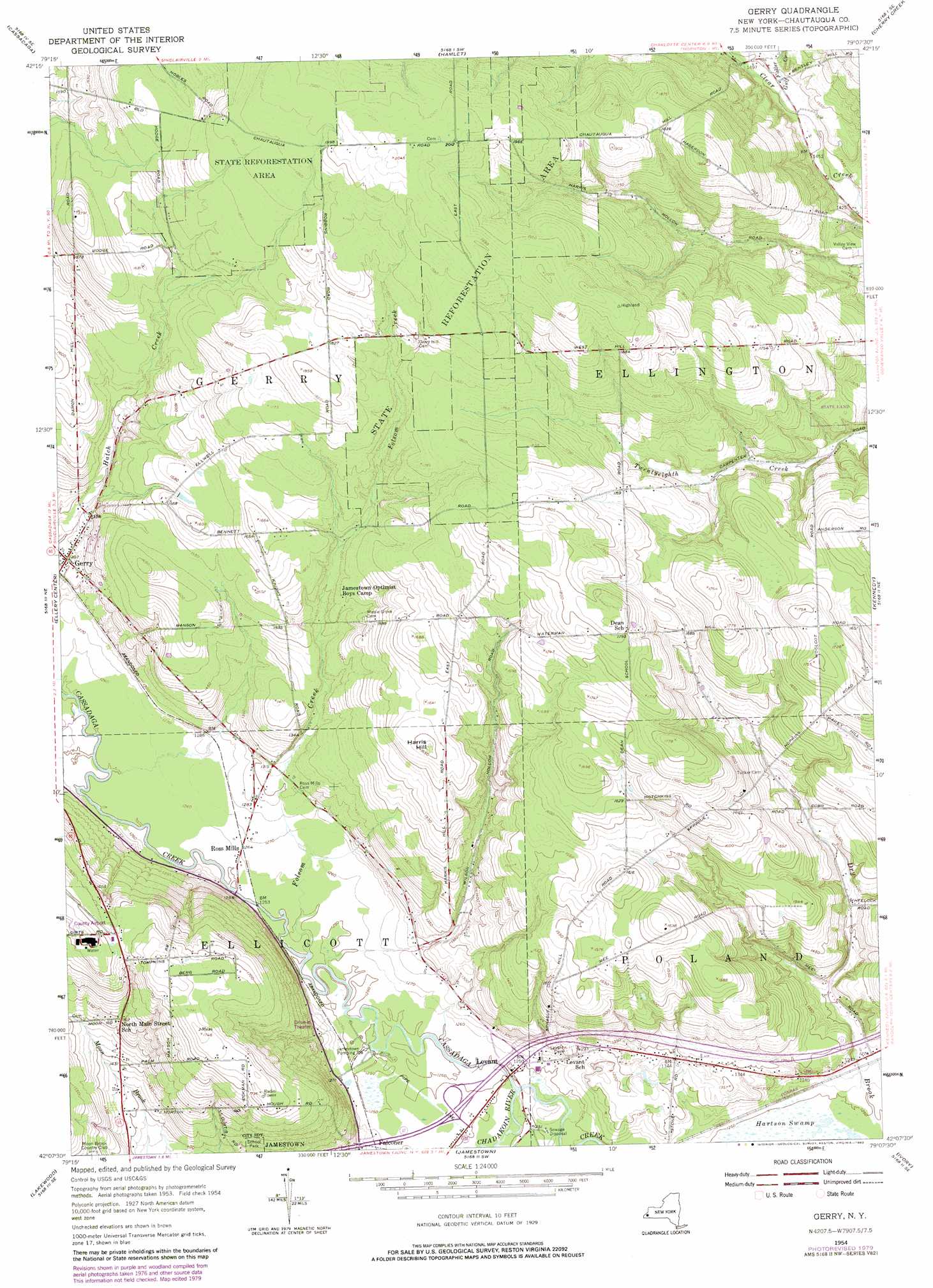
Gerry Topo Map New York
To zoom in, hover over the map of Gerry
USGS Topo Quad 42079b2 - 1:24,000 scale
| Topo Map Name: | Gerry |
| USGS Topo Quad ID: | 42079b2 |
| Print Size: | ca. 21 1/4" wide x 27" high |
| Southeast Coordinates: | 42.125° N latitude / 79.125° W longitude |
| Map Center Coordinates: | 42.1875° N latitude / 79.1875° W longitude |
| U.S. State: | NY |
| Filename: | o42079b2.jpg |
| Download Map JPG Image: | Gerry topo map 1:24,000 scale |
| Map Type: | Topographic |
| Topo Series: | 7.5´ |
| Map Scale: | 1:24,000 |
| Source of Map Images: | United States Geological Survey (USGS) |
| Alternate Map Versions: |
Gerry NY 1954, updated 1956 Download PDF Buy paper map Gerry NY 1954, updated 1968 Download PDF Buy paper map Gerry NY 1954, updated 1980 Download PDF Buy paper map Gerry NY 1954, updated 1980 Download PDF Buy paper map Gerry NY 2010 Download PDF Buy paper map Gerry NY 2013 Download PDF Buy paper map Gerry NY 2016 Download PDF Buy paper map |
1:24,000 Topo Quads surrounding Gerry
Brocton |
Dunkirk |
Forestville |
Perrysburg |
Gowanda |
Hartfield |
Cassadaga |
Hamlet |
Cherry Creek |
New Albion |
Chautauqua |
Ellery Center |
Gerry |
Kennedy |
Randolph |
Panama |
Lakewood |
Jamestown |
Ivory |
Steamburg |
Lottsville |
Sugar Grove |
Russell |
Scandia |
Cornplanter Run |
> Back to 42079a1 at 1:100,000 scale
> Back to 42078a1 at 1:250,000 scale
> Back to U.S. Topo Maps home
Gerry topo map: Gazetteer
Gerry: Forests
State Reforestation Area Number 10 elevation 598m 1961′Gerry: Populated Places
Gerry elevation 397m 1302′Levant elevation 381m 1250′
Ross Mills elevation 385m 1263′
Gerry: Streams
Chadakoin River elevation 377m 1236′Folsom Creek elevation 379m 1243′
Fuller Gulf Creek elevation 448m 1469′
Gerry: Summits
Harris Hill elevation 509m 1669′Gerry digital topo map on disk
Buy this Gerry topo map showing relief, roads, GPS coordinates and other geographical features, as a high-resolution digital map file on DVD:
 map DVD")