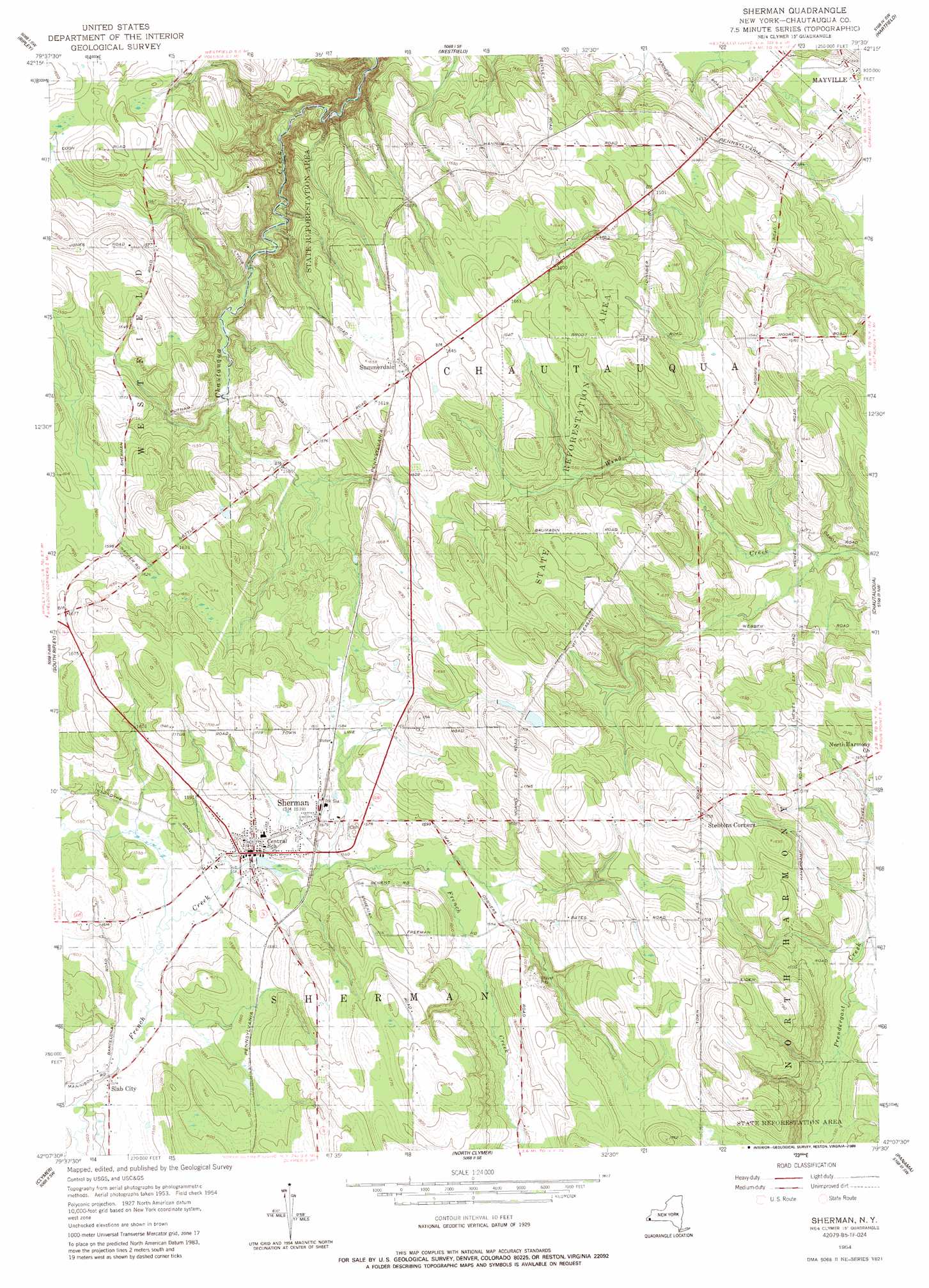
Sherman Topo Map New York
To zoom in, hover over the map of Sherman
USGS Topo Quad 42079b5 - 1:24,000 scale
| Topo Map Name: | Sherman |
| USGS Topo Quad ID: | 42079b5 |
| Print Size: | ca. 21 1/4" wide x 27" high |
| Southeast Coordinates: | 42.125° N latitude / 79.5° W longitude |
| Map Center Coordinates: | 42.1875° N latitude / 79.5625° W longitude |
| U.S. State: | NY |
| Filename: | o42079b5.jpg |
| Download Map JPG Image: | Sherman topo map 1:24,000 scale |
| Map Type: | Topographic |
| Topo Series: | 7.5´ |
| Map Scale: | 1:24,000 |
| Source of Map Images: | United States Geological Survey (USGS) |
| Alternate Map Versions: |
Sherman NY 1954, updated 1957 Download PDF Buy paper map Sherman NY 1954, updated 1988 Download PDF Buy paper map Sherman NY 1954, updated 1988 Download PDF Buy paper map Sherman NY 2010 Download PDF Buy paper map Sherman NY 2013 Download PDF Buy paper map Sherman NY 2016 Download PDF Buy paper map |
1:24,000 Topo Quads surrounding Sherman
Brocton |
Dunkirk |
|||
Ripley |
Westfield |
Hartfield |
Cassadaga |
|
North East |
South Ripley |
Sherman |
Chautauqua |
Ellery Center |
Wattsburg |
Clymer |
North Clymer |
Panama |
Lakewood |
Union City |
Corry |
Columbus |
Lottsville |
Sugar Grove |
> Back to 42079a1 at 1:100,000 scale
> Back to 42078a1 at 1:250,000 scale
> Back to U.S. Topo Maps home
Sherman topo map: Gazetteer
Sherman: Airports
Twin Ponds Airport elevation 529m 1735′Sherman: Forests
State Reforestation Area Chautauqua Number 11 elevation 483m 1584′Sherman: Populated Places
Sherman elevation 469m 1538′Slab City elevation 461m 1512′
Stebbins Corners elevation 534m 1751′
Summerdale elevation 501m 1643′
Sherman digital topo map on disk
Buy this Sherman topo map showing relief, roads, GPS coordinates and other geographical features, as a high-resolution digital map file on DVD:
 map DVD")