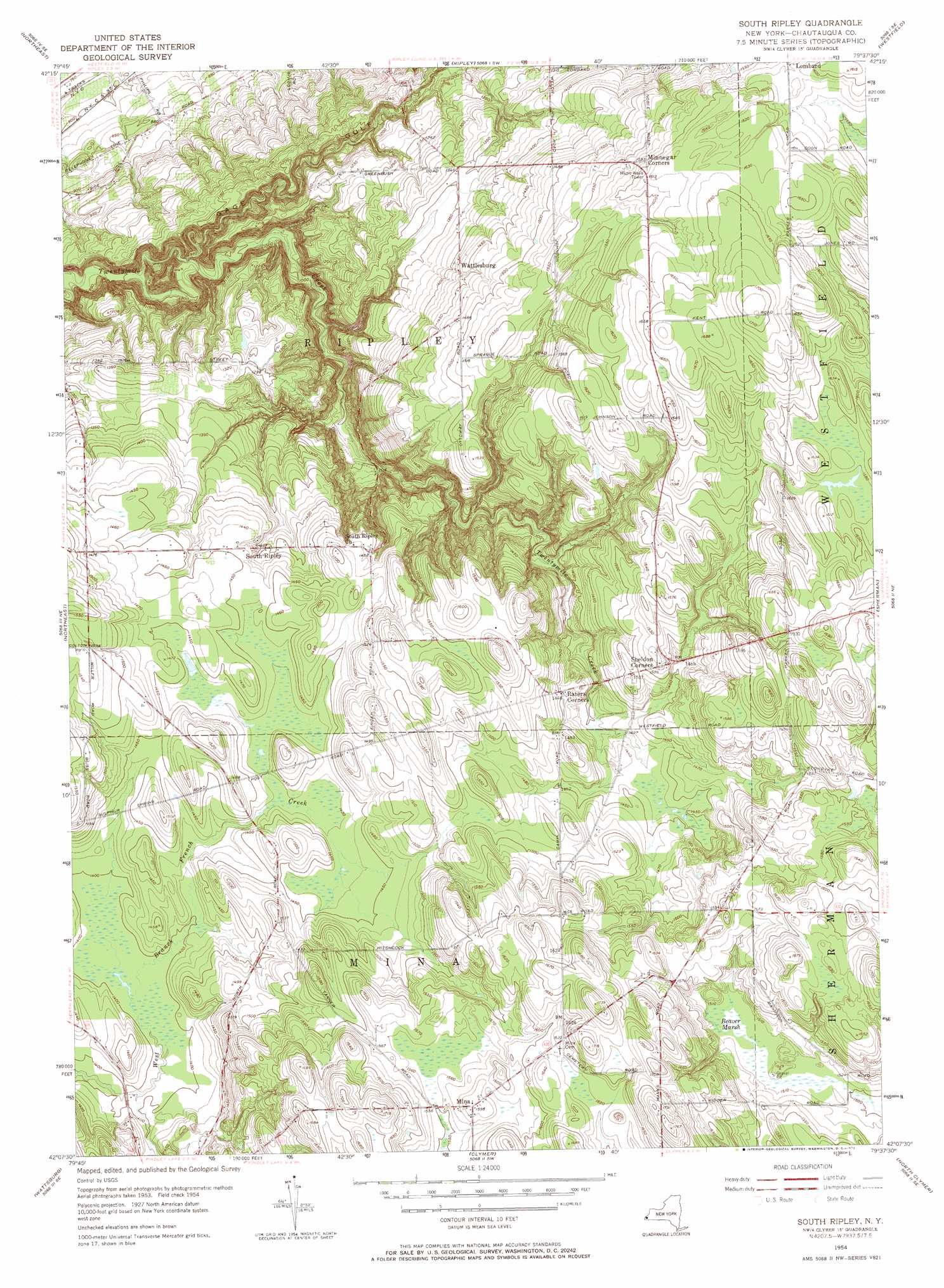
South Ripley Topo Map New York
To zoom in, hover over the map of South Ripley
USGS Topo Quad 42079b6 - 1:24,000 scale
| Topo Map Name: | South Ripley |
| USGS Topo Quad ID: | 42079b6 |
| Print Size: | ca. 21 1/4" wide x 27" high |
| Southeast Coordinates: | 42.125° N latitude / 79.625° W longitude |
| Map Center Coordinates: | 42.1875° N latitude / 79.6875° W longitude |
| U.S. State: | NY |
| Filename: | o42079b6.jpg |
| Download Map JPG Image: | South Ripley topo map 1:24,000 scale |
| Map Type: | Topographic |
| Topo Series: | 7.5´ |
| Map Scale: | 1:24,000 |
| Source of Map Images: | United States Geological Survey (USGS) |
| Alternate Map Versions: |
South Ripley NY 1954, updated 1956 Download PDF Buy paper map South Ripley NY 1954, updated 1972 Download PDF Buy paper map South Ripley NY 1954, updated 1972 Download PDF Buy paper map South Ripley NY 2010 Download PDF Buy paper map South Ripley NY 2013 Download PDF Buy paper map South Ripley NY 2016 Download PDF Buy paper map |
1:24,000 Topo Quads surrounding South Ripley
Brocton |
||||
Ripley |
Westfield |
Hartfield |
||
Harborcreek |
North East |
South Ripley |
Sherman |
Chautauqua |
Hammett |
Wattsburg |
Clymer |
North Clymer |
Panama |
Waterford |
Union City |
Corry |
Columbus |
Lottsville |
> Back to 42079a1 at 1:100,000 scale
> Back to 42078a1 at 1:250,000 scale
> Back to U.S. Topo Maps home
South Ripley topo map: Gazetteer
South Ripley: Airports
Pratts Eastern Divide Airport elevation 488m 1601′South Ripley: Populated Places
Mina elevation 486m 1594′South Ripley elevation 430m 1410′
Wattlesburg elevation 435m 1427′
South Ripley: Streams
Belson Creek elevation 273m 895′South Ripley: Swamps
Beaver Marsh elevation 458m 1502′South Ripley digital topo map on disk
Buy this South Ripley topo map showing relief, roads, GPS coordinates and other geographical features, as a high-resolution digital map file on DVD:
 map DVD")