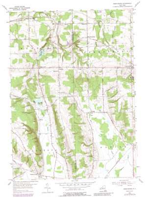
Perrysburg Topo Map New York
To zoom in, hover over the map of Perrysburg
USGS Topo Quad 42079d1 - 1:24,000 scale
| Topo Map Name: | Perrysburg |
| USGS Topo Quad ID: | 42079d1 |
| Print Size: | ca. 21 1/4" wide x 27" high |
| Southeast Coordinates: | 42.375° N latitude / 79° W longitude |
| Map Center Coordinates: | 42.4375° N latitude / 79.0625° W longitude |
| U.S. State: | NY |
| Filename: | o42079d1.jpg |
| Download Map JPG Image: | Perrysburg topo map 1:24,000 scale |
| Map Type: | Topographic |
| Topo Series: | 7.5´ |
| Map Scale: | 1:24,000 |
| Source of Map Images: | United States Geological Survey (USGS) |
| Alternate Map Versions: |
Perrysburg NY 1954, updated 1956 Download PDF Buy paper map Perrysburg NY 1954, updated 1972 Download PDF Buy paper map Perrysburg NY 1954, updated 1979 Download PDF Buy paper map Perrysburg NY 1954, updated 1988 Download PDF Buy paper map Perrysburg NY 2010 Download PDF Buy paper map Perrysburg NY 2013 Download PDF Buy paper map Perrysburg NY 2016 Download PDF Buy paper map |
1:24,000 Topo Quads surrounding Perrysburg
> Back to 42079a1 at 1:100,000 scale
> Back to 42078a1 at 1:250,000 scale
> Back to U.S. Topo Maps home
Perrysburg topo map: Gazetteer
Perrysburg: Airports
H and H Aviation Service Incorporated Heliport elevation 298m 977′Perrysburg: Lakes
East Mud Lake elevation 409m 1341′Perrysburg: Populated Places
Balltown elevation 287m 941′Cottage elevation 409m 1341′
Markhams elevation 403m 1322′
Nashville elevation 398m 1305′
Parcells Corners elevation 378m 1240′
Perrysburg elevation 403m 1322′
Smith Mills elevation 307m 1007′
Wango elevation 409m 1341′
West Perrysburg elevation 351m 1151′
Perrysburg: Reservoirs
Silver Creek Reservoir elevation 347m 1138′Perrysburg: Streams
Johnson Creek elevation 393m 1289′Wheeler Brook elevation 278m 912′
Perrysburg digital topo map on disk
Buy this Perrysburg topo map showing relief, roads, GPS coordinates and other geographical features, as a high-resolution digital map file on DVD:


