Farnham Topo Map New York
To zoom in, hover over the map of Farnham
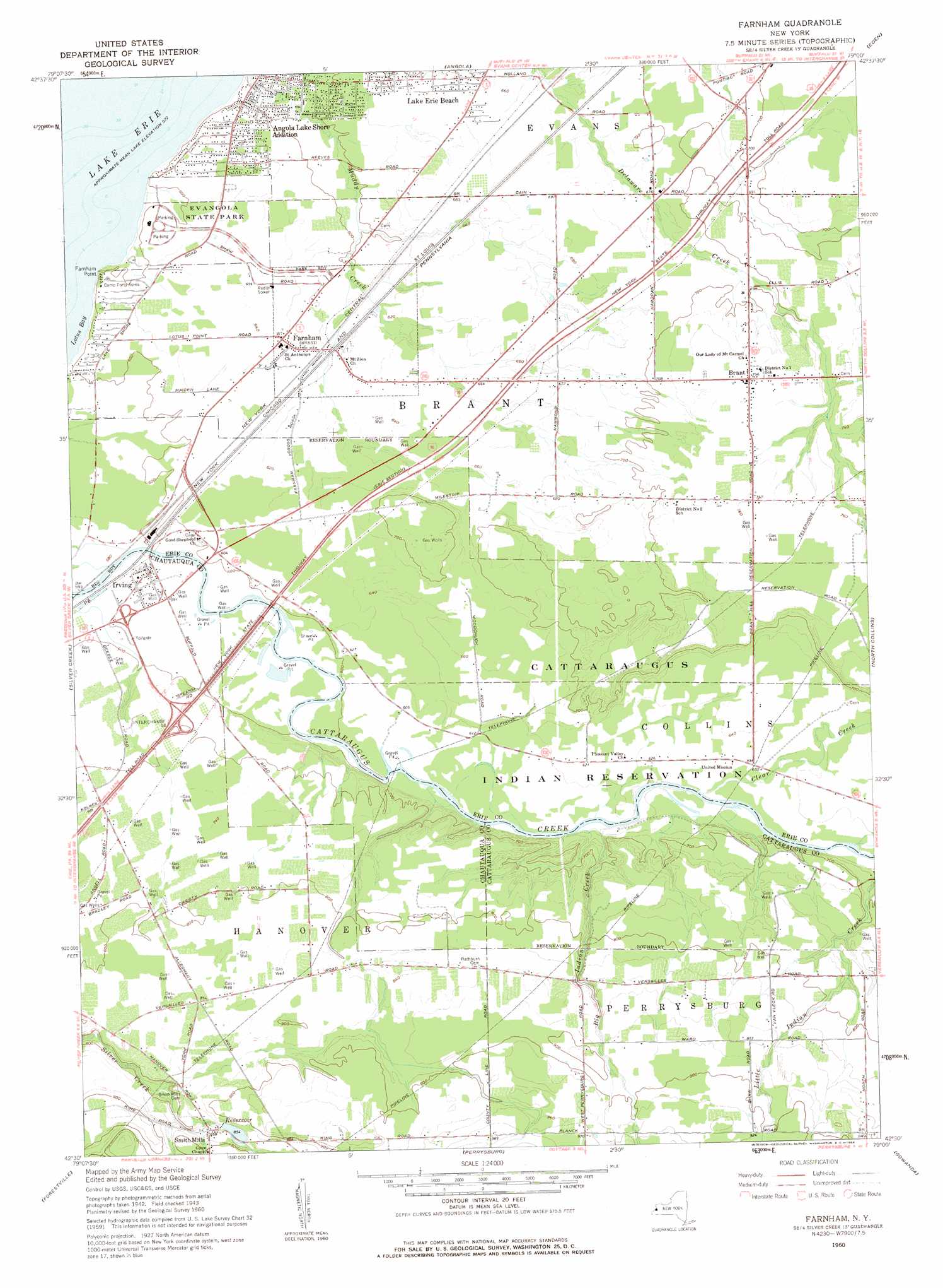
USGS Topo Quad 42079e1 - 1:24,000 scale
| Topo Map Name: | Farnham |
| USGS Topo Quad ID: | 42079e1 |
| Print Size: | ca. 21 1/4" wide x 27" high |
| Southeast Coordinates: | 42.5° N latitude / 79° W longitude |
| Map Center Coordinates: | 42.5625° N latitude / 79.0625° W longitude |
| U.S. State: | NY |
| Filename: | o42079e1.jpg |
| Download Map JPG Image: | Farnham topo map 1:24,000 scale |
| Map Type: | Topographic |
| Topo Series: | 7.5´ |
| Map Scale: | 1:24,000 |
| Source of Map Images: | United States Geological Survey (USGS) |
| Alternate Map Versions: |
Farnham NY 1960, updated 1963 Download PDF Buy paper map Farnham NY 1960, updated 1984 Download PDF Buy paper map Farnham NY 2010 Download PDF Buy paper map Farnham NY 2013 Download PDF Buy paper map Farnham NY 2016 Download PDF Buy paper map |
1:24,000 Topo Quads surrounding Farnham
Buffalo Se |
||||
Angola |
Eden |
Hamburg |
||
North Of Dunkirk |
Silver Creek |
Farnham |
North Collins |
Langford |
Dunkirk |
Forestville |
Perrysburg |
Gowanda |
Collins Center |
Cassadaga |
Hamlet |
Cherry Creek |
New Albion |
Cattaraugus |
> Back to 42079e1 at 1:100,000 scale
> Back to 42078a1 at 1:250,000 scale
> Back to U.S. Topo Maps home
Farnham topo map: Gazetteer
Farnham: Bays
Lotus Bay elevation 174m 570′Farnham: Capes
Farnham Point elevation 177m 580′Farnham: Crossings
Interchange 58 elevation 207m 679′Farnham: Parks
Evangola State Park elevation 189m 620′Farnham: Populated Places
Angola Lake Shore Addition elevation 194m 636′Brant elevation 227m 744′
Farnham elevation 195m 639′
Irving elevation 178m 583′
Lake Erie Beach elevation 191m 626′
West Creek Mobile Home Park elevation 232m 761′
Farnham: Streams
Big Indian Creek elevation 183m 600′Clear Creek elevation 183m 600′
Farnham digital topo map on disk
Buy this Farnham topo map showing relief, roads, GPS coordinates and other geographical features, as a high-resolution digital map file on DVD:
 map DVD")