Marine City Topo Map Michigan
To zoom in, hover over the map of Marine City
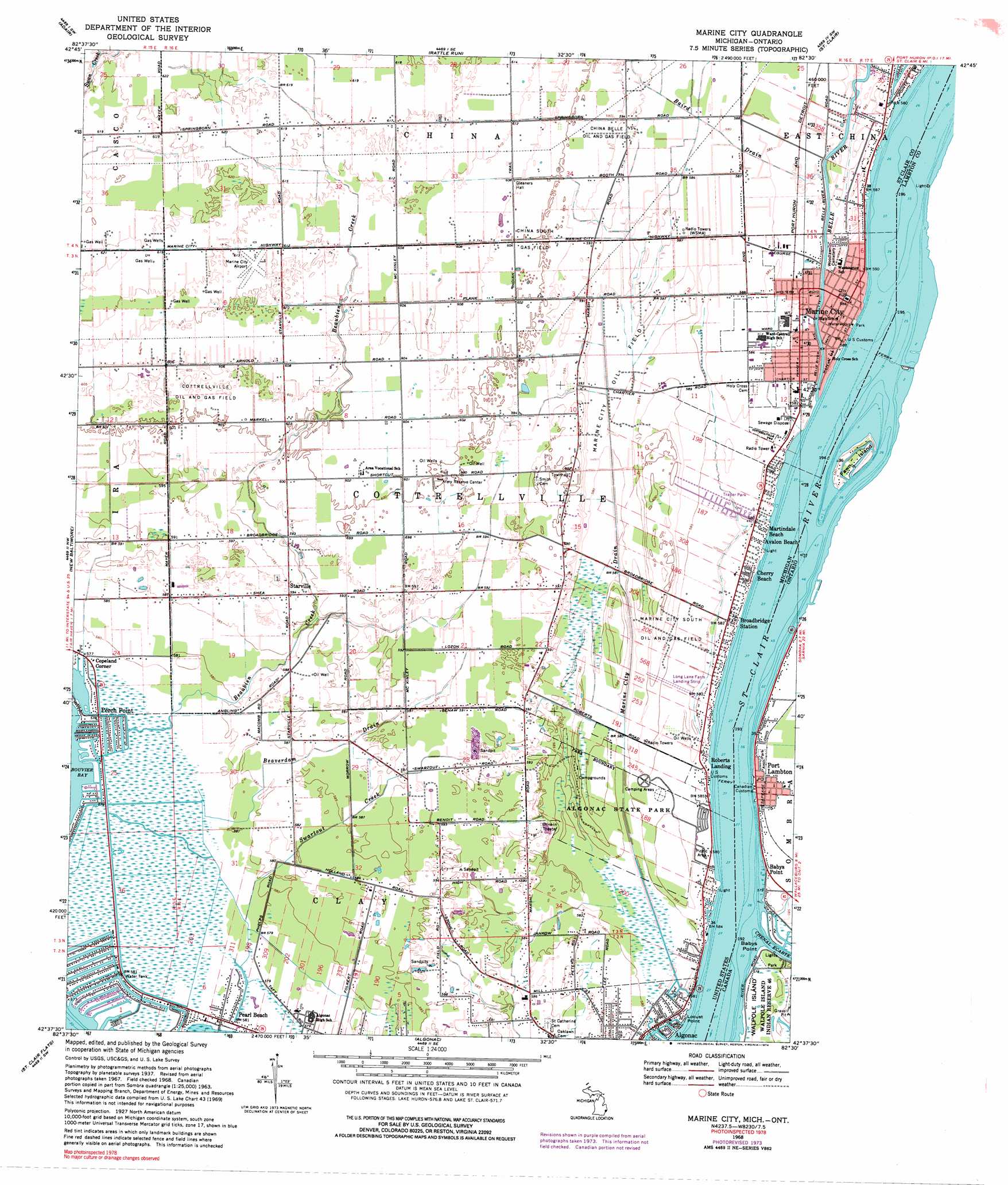
USGS Topo Quad 42082f5 - 1:24,000 scale
| Topo Map Name: | Marine City |
| USGS Topo Quad ID: | 42082f5 |
| Print Size: | ca. 21 1/4" wide x 27" high |
| Southeast Coordinates: | 42.625° N latitude / 82.5° W longitude |
| Map Center Coordinates: | 42.6875° N latitude / 82.5625° W longitude |
| U.S. State: | MI |
| Filename: | o42082f5.jpg |
| Download Map JPG Image: | Marine City topo map 1:24,000 scale |
| Map Type: | Topographic |
| Topo Series: | 7.5´ |
| Map Scale: | 1:24,000 |
| Source of Map Images: | United States Geological Survey (USGS) |
| Alternate Map Versions: |
Marine City MI 1939 Download PDF Buy paper map Marine City MI 1952, updated 1954 Download PDF Buy paper map Marine City MI 1968, updated 1971 Download PDF Buy paper map Marine City MI 1968, updated 1974 Download PDF Buy paper map Marine City MI 1968, updated 1974 Download PDF Buy paper map Marine City MI 2011 Download PDF Buy paper map Marine City MI 2014 Download PDF Buy paper map Marine City MI 2017 Download PDF Buy paper map |
1:24,000 Topo Quads surrounding Marine City
Memphis |
Goodells |
Smiths Creek |
Port Huron |
|
Richmond |
Adair |
Rattle Run |
Saint Clair |
|
New Haven |
New Baltimore |
Marine City |
||
Mount Clemens East |
Saint Clair Flats |
Algonac |
||
> Back to 42082e1 at 1:100,000 scale
> Back to 42082a1 at 1:250,000 scale
> Back to U.S. Topo Maps home
Marine City topo map: Gazetteer
Marine City: Airports
Long Land Farm Landing Strip elevation 178m 583′Marine City Airport elevation 186m 610′
Marine City: Capes
Locust Point elevation 176m 577′Marine City: Oilfields
China Belle Oil and Gas Field elevation 181m 593′China South Gas Field elevation 183m 600′
Cottrellville Oil and Gas Field elevation 184m 603′
Marine City Oil Field elevation 177m 580′
Marine City South Oil and Gas Field elevation 179m 587′
Marine City: Parks
Algonac State Park elevation 177m 580′Colony Tower Historical Marker elevation 177m 580′
Saint Clair River Historical Marker elevation 176m 577′
Marine City: Populated Places
Avalon Beach elevation 178m 583′Broadbridge Station elevation 177m 580′
Cherry Beach elevation 177m 580′
Copeland Corner elevation 177m 580′
Martindale Beach elevation 177m 580′
Pearl Beach elevation 176m 577′
Perch Point elevation 176m 577′
Roberts Landing elevation 177m 580′
Starville elevation 181m 593′
Tag-A-Long Trailer Court elevation 177m 580′
Marine City: Post Offices
Pearl Beach Post Office elevation 176m 577′Roberts Landing Post Office (historical) elevation 177m 580′
Starrville Post Office (historical) elevation 181m 593′
Marine City: Streams
Beaubien Creek elevation 175m 574′Beaverdam Drain elevation 176m 577′
Marine City Drain elevation 175m 574′
Swartout Creek elevation 176m 577′
Marine City digital topo map on disk
Buy this Marine City topo map showing relief, roads, GPS coordinates and other geographical features, as a high-resolution digital map file on DVD:
 map DVD")