Milan Topo Map Michigan
To zoom in, hover over the map of Milan
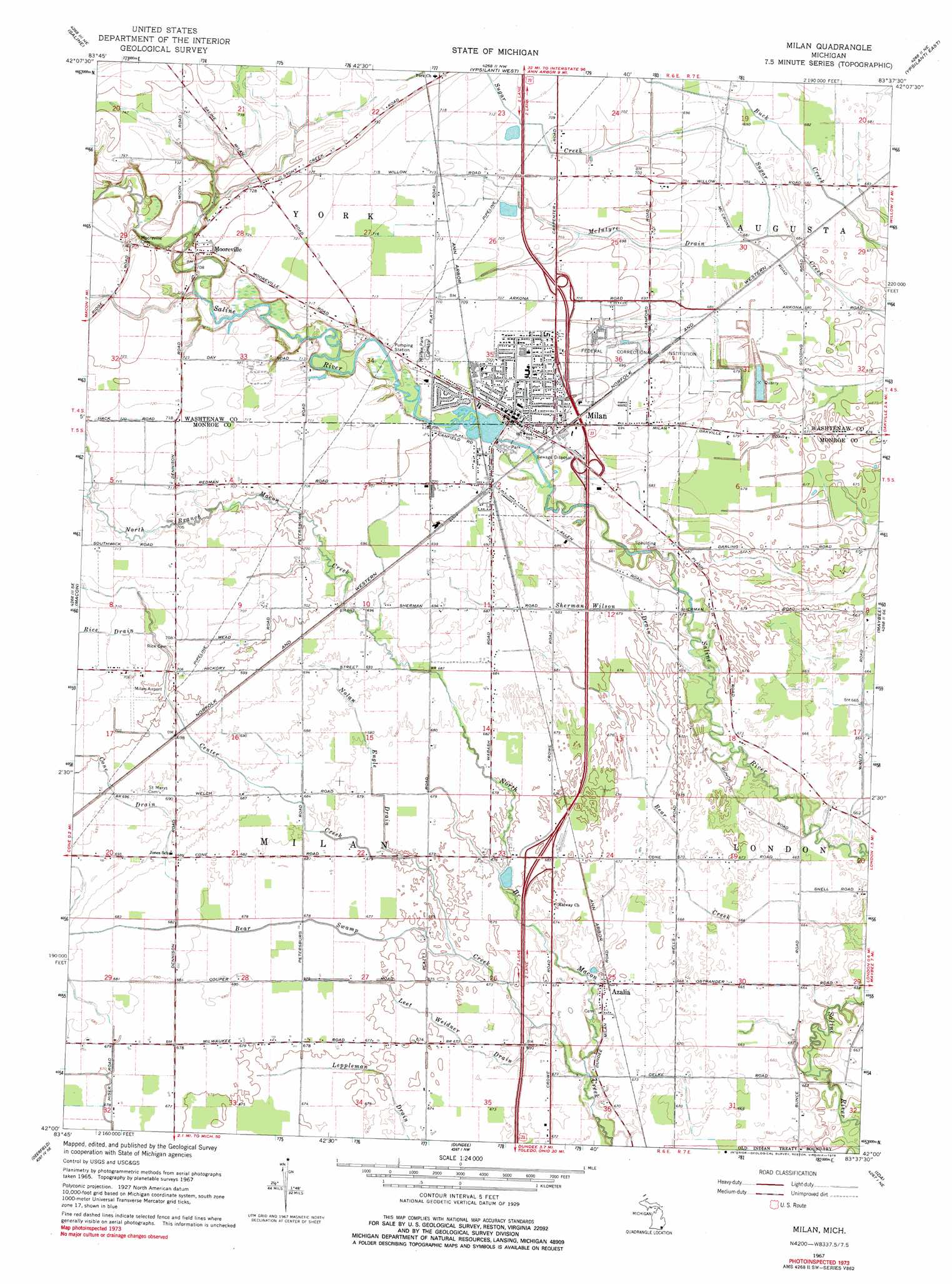
USGS Topo Quad 42083a6 - 1:24,000 scale
| Topo Map Name: | Milan |
| USGS Topo Quad ID: | 42083a6 |
| Print Size: | ca. 21 1/4" wide x 27" high |
| Southeast Coordinates: | 42° N latitude / 83.625° W longitude |
| Map Center Coordinates: | 42.0625° N latitude / 83.6875° W longitude |
| U.S. State: | MI |
| Filename: | o42083a6.jpg |
| Download Map JPG Image: | Milan topo map 1:24,000 scale |
| Map Type: | Topographic |
| Topo Series: | 7.5´ |
| Map Scale: | 1:24,000 |
| Source of Map Images: | United States Geological Survey (USGS) |
| Alternate Map Versions: |
Milan MI 1967, updated 1970 Download PDF Buy paper map Milan MI 2011 Download PDF Buy paper map Milan MI 2014 Download PDF Buy paper map Milan MI 2017 Download PDF Buy paper map |
1:24,000 Topo Quads surrounding Milan
Dexter |
Ann Arbor West |
Ann Arbor East |
Denton |
Wayne |
Bridgewater |
Saline |
Ypsilanti West |
Ypsilanti East |
Belleville |
Tecumseh North |
Macon |
Milan |
Maybee |
Carleton |
Tecumseh South |
Deerfield |
Dundee |
Ida |
Monroe |
Palmyra |
Blissfield |
Lambertville West |
Lambertville East |
Erie |
> Back to 42083a1 at 1:100,000 scale
> Back to 42082a1 at 1:250,000 scale
> Back to U.S. Topo Maps home
Milan topo map: Gazetteer
Milan: Airports
Milan Airport elevation 214m 702′Milan: Crossings
Interchange 22 elevation 208m 682′Interchange 25 elevation 209m 685′
Milan: Populated Places
Azalia elevation 204m 669′Milan elevation 214m 702′
Mooreville elevation 220m 721′
York elevation 215m 705′
Milan: Post Offices
Azalia Post Office elevation 204m 669′Milan: Streams
Bear Swamp Creek elevation 200m 656′Center Creek elevation 203m 666′
Cone Drain elevation 207m 679′
Leet Weidner Drain elevation 203m 666′
McIntyre Drain elevation 206m 675′
Nolan Engle Drain elevation 205m 672′
Rice Drain elevation 213m 698′
Sherman Wilson Drain elevation 203m 666′
Milan digital topo map on disk
Buy this Milan topo map showing relief, roads, GPS coordinates and other geographical features, as a high-resolution digital map file on DVD:
 map DVD")