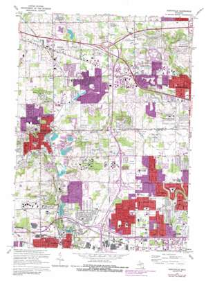
Northville Topo Map Michigan
To zoom in, hover over the map of Northville
USGS Topo Quad 42083d4 - 1:24,000 scale
| Topo Map Name: | Northville |
| USGS Topo Quad ID: | 42083d4 |
| Print Size: | ca. 21 1/4" wide x 27" high |
| Southeast Coordinates: | 42.375° N latitude / 83.375° W longitude |
| Map Center Coordinates: | 42.4375° N latitude / 83.4375° W longitude |
| U.S. State: | MI |
| Filename: | o42083d4.jpg |
| Download Map JPG Image: | Northville topo map 1:24,000 scale |
| Map Type: | Topographic |
| Topo Series: | 7.5´ |
| Map Scale: | 1:24,000 |
| Source of Map Images: | United States Geological Survey (USGS) |
| Alternate Map Versions: |
Northville MI 1945 Download PDF Buy paper map Northville MI 1952, updated 1954 Download PDF Buy paper map Northville MI 1969, updated 1971 Download PDF Buy paper map Northville MI 1969, updated 1974 Download PDF Buy paper map Northville MI 1969, updated 1981 Download PDF Buy paper map Northville MI 1969, updated 1988 Download PDF Buy paper map Northville MI 2011 Download PDF Buy paper map Northville MI 2014 Download PDF Buy paper map Northville MI 2017 Download PDF Buy paper map |
1:24,000 Topo Quads surrounding Northville
> Back to 42083a1 at 1:100,000 scale
> Back to 42082a1 at 1:250,000 scale
> Back to U.S. Topo Maps home
Northville topo map: Gazetteer
Northville: Airports
Glen Oaks Heliport elevation 274m 898′Guardian Industries Heliport elevation 255m 836′
Independence Green Heliport elevation 248m 813′
Northville: Canals
Barlow Drain elevation 201m 659′Gates Drain elevation 198m 649′
Patter Drain elevation 201m 659′
Northville: Lakes
Curtis Lake elevation 242m 793′Northville: Parks
Auburn Playground elevation 233m 764′Cass Benton Park elevation 246m 807′
Castle Gardens Park elevation 213m 698′
Denton Park elevation 243m 797′
Founders Sports Park elevation 226m 741′
Henry Ford Field elevation 204m 669′
Northville: Populated Places
Farmington elevation 229m 751′Farmington Acres elevation 217m 711′
Farmington Hills elevation 259m 849′
Grand View Acres elevation 266m 872′
Northville elevation 252m 826′
Novi elevation 277m 908′
Quakertown elevation 259m 849′
Northville: Reservoirs
Phoenix Lake elevation 219m 718′Waterford Pond elevation 229m 751′
Wilcox Lake elevation 213m 698′
Northville: Streams
Bishop Creek elevation 255m 836′Gunn Branch elevation 204m 669′
Johnson Drain elevation 234m 767′
Minnow Pond Drain elevation 231m 757′
Seeley Drain elevation 231m 757′
Thornton Creek elevation 251m 823′
Walled Lake Branch elevation 236m 774′
Northville digital topo map on disk
Buy this Northville topo map showing relief, roads, GPS coordinates and other geographical features, as a high-resolution digital map file on DVD:


