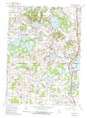
Hamburg Topo Map Michigan
To zoom in, hover over the map of Hamburg
USGS Topo Quad 42083d7 - 1:24,000 scale
| Topo Map Name: | Hamburg |
| USGS Topo Quad ID: | 42083d7 |
| Print Size: | ca. 21 1/4" wide x 27" high |
| Southeast Coordinates: | 42.375° N latitude / 83.75° W longitude |
| Map Center Coordinates: | 42.4375° N latitude / 83.8125° W longitude |
| U.S. State: | MI |
| Filename: | o42083d7.jpg |
| Download Map JPG Image: | Hamburg topo map 1:24,000 scale |
| Map Type: | Topographic |
| Topo Series: | 7.5´ |
| Map Scale: | 1:24,000 |
| Source of Map Images: | United States Geological Survey (USGS) |
| Alternate Map Versions: |
Hamburg MI 1965, updated 1967 Download PDF Buy paper map Hamburg MI 1965, updated 1977 Download PDF Buy paper map Hamburg MI 1965, updated 1984 Download PDF Buy paper map Hamburg MI 1996, updated 2000 Download PDF Buy paper map Hamburg MI 2011 Download PDF Buy paper map Hamburg MI 2014 Download PDF Buy paper map Hamburg MI 2017 Download PDF Buy paper map |
1:24,000 Topo Quads surrounding Hamburg
> Back to 42083a1 at 1:100,000 scale
> Back to 42082a1 at 1:250,000 scale
> Back to U.S. Topo Maps home
Hamburg topo map: Gazetteer
Hamburg: Airports
Cackleberry Airport elevation 271m 889′Gooding Airport elevation 284m 931′
Hamburg: Lakes
Arms Lake elevation 266m 872′Bass Lake elevation 260m 853′
Bishop Lake elevation 271m 889′
Buck Lake elevation 260m 853′
Caroga Lake elevation 271m 889′
Cordley Lake elevation 260m 853′
Cygnet Pond elevation 273m 895′
Dibrova Lake elevation 263m 862′
Gallagher Lake elevation 259m 849′
Gut Lake elevation 262m 859′
Hamburg Lake elevation 269m 882′
Horseshoe Lake elevation 274m 898′
Independence Lake elevation 269m 882′
Lake Mohican elevation 260m 853′
Loon Lake elevation 259m 849′
Maltby Lake elevation 263m 862′
Mud Lake elevation 269m 882′
Oneida Lake elevation 260m 853′
Ore Lake elevation 260m 853′
Strawberry Lake elevation 260m 853′
Whitmore Lake elevation 272m 892′
Wildwood Lake elevation 275m 902′
Winans Lake elevation 262m 859′
Wolf Lake elevation 260m 853′
Zukey Lake elevation 260m 853′
Hamburg: Populated Places
Hamburg elevation 273m 895′Lakeland elevation 262m 859′
Parishfield elevation 307m 1007′
Pettysville elevation 267m 875′
Webster elevation 274m 898′
Hamburg: Post Offices
Lakeland Post Office (historical) elevation 262m 859′Hamburg: Streams
Chilson Creek elevation 260m 853′O'connor Drain elevation 274m 898′
South Ore Creek elevation 260m 853′
Hamburg digital topo map on disk
Buy this Hamburg topo map showing relief, roads, GPS coordinates and other geographical features, as a high-resolution digital map file on DVD:


