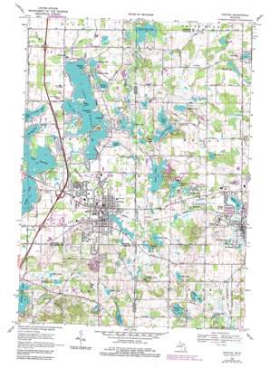
Fenton Topo Map Michigan
To zoom in, hover over the map of Fenton
USGS Topo Quad 42083g6 - 1:24,000 scale
| Topo Map Name: | Fenton |
| USGS Topo Quad ID: | 42083g6 |
| Print Size: | ca. 21 1/4" wide x 27" high |
| Southeast Coordinates: | 42.75° N latitude / 83.625° W longitude |
| Map Center Coordinates: | 42.8125° N latitude / 83.6875° W longitude |
| U.S. State: | MI |
| Filename: | o42083g6.jpg |
| Download Map JPG Image: | Fenton topo map 1:24,000 scale |
| Map Type: | Topographic |
| Topo Series: | 7.5´ |
| Map Scale: | 1:24,000 |
| Source of Map Images: | United States Geological Survey (USGS) |
| Alternate Map Versions: |
Fenton MI 1969, updated 1971 Download PDF Buy paper map Fenton MI 1969, updated 1976 Download PDF Buy paper map Fenton MI 1969, updated 1984 Download PDF Buy paper map Fenton MI 2011 Download PDF Buy paper map Fenton MI 2014 Download PDF Buy paper map Fenton MI 2017 Download PDF Buy paper map |
1:24,000 Topo Quads surrounding Fenton
> Back to 42083e1 at 1:100,000 scale
> Back to 42082a1 at 1:250,000 scale
> Back to U.S. Topo Maps home
Fenton topo map: Gazetteer
Fenton: Bays
Crane Cove elevation 266m 872′Fenton: Canals
Bare Drain elevation 277m 908′Egyptian Drain elevation 270m 885′
Patterson Holly Drain elevation 277m 908′
Fenton: Capes
Log Cabin Point elevation 267m 875′Orrs Point elevation 267m 875′
Fenton: Crossings
Interchange 78 elevation 280m 918′Interchange 79 elevation 279m 915′
Interchange 80 elevation 275m 902′
Interchange 84 elevation 268m 879′
Fenton: Islands
Case Island elevation 269m 882′Fenton: Lakes
Arrowhead Lake elevation 290m 951′Baker Lake elevation 283m 928′
Baldwin Lake elevation 282m 925′
Barnum Lake elevation 265m 869′
Bevins Lake elevation 278m 912′
Butcher Lake elevation 288m 944′
Cady Lake elevation 263m 862′
Copneconic Lake elevation 257m 843′
Crane Lake elevation 265m 869′
Crooked Lake elevation 257m 843′
Denton Lake elevation 294m 964′
Dickinson Lake elevation 270m 885′
Dollar Lake elevation 265m 869′
Elliott Lake elevation 300m 984′
Goodfellow Lake elevation 275m 902′
Hollyshire Lake elevation 266m 872′
Kennedy Lake elevation 273m 895′
Lake Bars Leak elevation 283m 928′
Lake Fenton elevation 266m 872′
Lake Iroquois elevation 266m 872′
Lake Ponemah elevation 264m 866′
Lake Urban elevation 276m 905′
Little Long Lake elevation 265m 869′
McCully Lake elevation 260m 853′
Minnock Lake elevation 279m 915′
Mitchell Lake elevation 273m 895′
Mud Lake elevation 273m 895′
Nichols Lake elevation 269m 882′
Oyster Lake elevation 259m 849′
Petts Lake elevation 263m 862′
Pine Lake elevation 264m 866′
Richardson Lake elevation 211m 692′
Spring Lake elevation 272m 892′
Squaw Lake elevation 264m 866′
Sullivan Lake elevation 300m 984′
Taylor Lake elevation 303m 994′
Tremper Lake elevation 272m 892′
Westman Lake elevation 273m 895′
Wilson Lake elevation 273m 895′
Fenton: Parks
Bush Park elevation 270m 885′Dibbleville Historical Marker elevation 276m 905′
Fenton House Historical Marker elevation 275m 902′
Fenton United Methodist Church Historical Marker elevation 275m 902′
Franklin Park elevation 269m 882′
Old Prospect Hill Cemetery Historical Marker elevation 296m 971′
Saint Jude's Episcopal Church Historical Marker elevation 276m 905′
Silver Lake Park elevation 276m 905′
Fenton: Populated Places
Bayport Park elevation 271m 889′Fenton elevation 275m 902′
Fenton Oaks Mobile Home Community elevation 275m 902′
Holly elevation 283m 928′
Lake Fenton elevation 268m 879′
Lakeside elevation 268m 879′
Loon Lake Manufactured Home Community elevation 268m 879′
Newark elevation 284m 931′
Fenton: Post Offices
Fenton Post Office elevation 273m 895′Mundy Post Office (historical) elevation 268m 879′
Fenton: Reservoirs
Seven Lakes elevation 268m 879′Silver Lake elevation 267m 875′
Fenton: Streams
Denton Creek elevation 271m 889′Fenton digital topo map on disk
Buy this Fenton topo map showing relief, roads, GPS coordinates and other geographical features, as a high-resolution digital map file on DVD:


