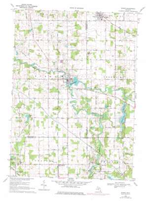
Byron Topo Map Michigan
To zoom in, hover over the map of Byron
USGS Topo Quad 42083g8 - 1:24,000 scale
| Topo Map Name: | Byron |
| USGS Topo Quad ID: | 42083g8 |
| Print Size: | ca. 21 1/4" wide x 27" high |
| Southeast Coordinates: | 42.75° N latitude / 83.875° W longitude |
| Map Center Coordinates: | 42.8125° N latitude / 83.9375° W longitude |
| U.S. State: | MI |
| Filename: | o42083g8.jpg |
| Download Map JPG Image: | Byron topo map 1:24,000 scale |
| Map Type: | Topographic |
| Topo Series: | 7.5´ |
| Map Scale: | 1:24,000 |
| Source of Map Images: | United States Geological Survey (USGS) |
| Alternate Map Versions: |
Byron MI 1969, updated 1971 Download PDF Buy paper map Byron MI 1969, updated 1976 Download PDF Buy paper map Byron MI 1969, updated 1976 Download PDF Buy paper map Byron MI 2011 Download PDF Buy paper map Byron MI 2014 Download PDF Buy paper map Byron MI 2017 Download PDF Buy paper map |
1:24,000 Topo Quads surrounding Byron
> Back to 42083e1 at 1:100,000 scale
> Back to 42082a1 at 1:250,000 scale
> Back to U.S. Topo Maps home
Byron topo map: Gazetteer
Byron: Airports
Hiram Cure Airport elevation 271m 889′Byron: Canals
Bear Swamp Drain elevation 258m 846′Bills Drain elevation 253m 830′
Burns and Vernon Drain elevation 256m 839′
Cohoctah and Barnum Drain elevation 257m 843′
Drake Drain elevation 256m 839′
Kanause Lake Drain elevation 252m 826′
Livingston Shiawassee Drain elevation 266m 872′
Salesbury Drain elevation 256m 839′
Sanford Neal Drain elevation 258m 846′
Yellow River Drain elevation 256m 839′
Byron: Lakes
Crawford Lake elevation 264m 866′Kanause Lake elevation 256m 839′
Lillie Lake elevation 264m 866′
McKane Lake elevation 256m 839′
Mud Lake elevation 258m 846′
Myers Lake elevation 256m 839′
Rider Lake elevation 255m 836′
Shaw Lake elevation 251m 823′
Shuler Lake elevation 265m 869′
Byron: Parks
Bryon Cemetery Historical Marker elevation 259m 849′Byron Historical Marker elevation 257m 843′
Byron Sesquicentennial Park elevation 252m 826′
Ellen May Tower Historical Marker elevation 255m 836′
Spanish-American War Nurse Historical Marker elevation 255m 836′
Byron: Populated Places
Byron elevation 257m 843′Cohoctah elevation 270m 885′
Cohoctah Center elevation 266m 872′
Deer Creek elevation 269m 882′
Gaines elevation 261m 856′
Byron: Post Offices
Byron Post Office elevation 259m 849′Cohocta Post Office elevation 270m 885′
Cohoctah Post Office (historical) elevation 266m 872′
Gaines Post Office elevation 261m 856′
Byron: Reservoirs
Byron Millpond elevation 250m 820′Byron: Streams
Cranberry Creek elevation 257m 843′South Branch Shiawassee River elevation 249m 816′
Byron digital topo map on disk
Buy this Byron topo map showing relief, roads, GPS coordinates and other geographical features, as a high-resolution digital map file on DVD:


