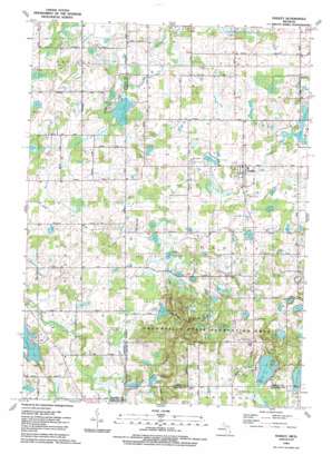
Hadley Topo Map Michigan
To zoom in, hover over the map of Hadley
USGS Topo Quad 42083h4 - 1:24,000 scale
| Topo Map Name: | Hadley |
| USGS Topo Quad ID: | 42083h4 |
| Print Size: | ca. 21 1/4" wide x 27" high |
| Southeast Coordinates: | 42.875° N latitude / 83.375° W longitude |
| Map Center Coordinates: | 42.9375° N latitude / 83.4375° W longitude |
| U.S. State: | MI |
| Filename: | o42083h4.jpg |
| Download Map JPG Image: | Hadley topo map 1:24,000 scale |
| Map Type: | Topographic |
| Topo Series: | 7.5´ |
| Map Scale: | 1:24,000 |
| Source of Map Images: | United States Geological Survey (USGS) |
| Alternate Map Versions: |
Hadley MI 1945 Download PDF Buy paper map Hadley MI 1968, updated 1970 Download PDF Buy paper map Hadley MI 1968, updated 1981 Download PDF Buy paper map Hadley MI 1991, updated 1991 Download PDF Buy paper map Hadley MI 2011 Download PDF Buy paper map Hadley MI 2014 Download PDF Buy paper map Hadley MI 2017 Download PDF Buy paper map |
1:24,000 Topo Quads surrounding Hadley
> Back to 42083e1 at 1:100,000 scale
> Back to 42082a1 at 1:250,000 scale
> Back to U.S. Topo Maps home
Hadley topo map: Gazetteer
Hadley: Capes
Pinnacle Point elevation 318m 1043′Hadley: Guts
Hasler Inlet elevation 258m 846′Hadley: Lakes
Algoe Lake elevation 293m 961′Big Fish Lake elevation 321m 1053′
Brigham Lake elevation 283m 928′
Bunnel Lake elevation 283m 928′
Davison Lake elevation 325m 1066′
Fox Lake elevation 289m 948′
Hanover Lake elevation 251m 823′
Hasley Lake elevation 258m 846′
Hemingway Lake elevation 273m 895′
Koester Lakes elevation 288m 944′
Kuhn Lake elevation 277m 908′
Lake Marion elevation 293m 961′
Mitten Lake elevation 283m 928′
Riley Lake elevation 277m 908′
Round Lake elevation 319m 1046′
Sawmill Lake elevation 286m 938′
Seeley Lake elevation 257m 843′
Tody Lake elevation 292m 958′
Webster Lake elevation 300m 984′
Hadley: Parks
Ortonville State Recreation Area elevation 314m 1030′Hadley: Populated Places
Hadley elevation 275m 902′Kerr Hill elevation 355m 1164′
Hadley: Post Offices
Hadley Post Office elevation 275m 902′Kipp's Corners Post Office (historical) elevation 284m 931′
Hadley: Ranges
Hadley Hills elevation 332m 1089′Hadley: Streams
Mill Creek elevation 264m 866′Paddison Drain elevation 277m 908′
Spring Bank Creek elevation 283m 928′
Hadley digital topo map on disk
Buy this Hadley topo map showing relief, roads, GPS coordinates and other geographical features, as a high-resolution digital map file on DVD:


