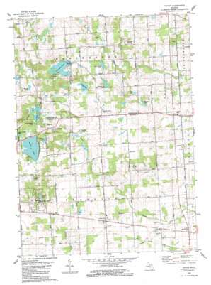
Tipton Topo Map Michigan
To zoom in, hover over the map of Tipton
USGS Topo Quad 42084a1 - 1:24,000 scale
| Topo Map Name: | Tipton |
| USGS Topo Quad ID: | 42084a1 |
| Print Size: | ca. 21 1/4" wide x 27" high |
| Southeast Coordinates: | 42° N latitude / 84° W longitude |
| Map Center Coordinates: | 42.0625° N latitude / 84.0625° W longitude |
| U.S. State: | MI |
| Filename: | o42084a1.jpg |
| Download Map JPG Image: | Tipton topo map 1:24,000 scale |
| Map Type: | Topographic |
| Topo Series: | 7.5´ |
| Map Scale: | 1:24,000 |
| Source of Map Images: | United States Geological Survey (USGS) |
| Alternate Map Versions: |
Tipton MI 1980, updated 1981 Download PDF Buy paper map Tipton MI 2011 Download PDF Buy paper map Tipton MI 2014 Download PDF Buy paper map Tipton MI 2017 Download PDF Buy paper map |
1:24,000 Topo Quads surrounding Tipton
> Back to 42084a1 at 1:100,000 scale
> Back to 42084a1 at 1:250,000 scale
> Back to U.S. Topo Maps home
Tipton topo map: Gazetteer
Tipton: Lakes
Cranberry Lake elevation 273m 895′Evans Lake elevation 292m 958′
Half Moon Lake elevation 273m 895′
Hidden Lake elevation 290m 951′
Hudson Lake elevation 274m 898′
Iron Mill Pond elevation 279m 915′
Jefferey Lake elevation 291m 954′
Keeney Lake elevation 285m 935′
Lower Lake elevation 280m 918′
Reynolds Lake elevation 280m 918′
Smalley Lake elevation 273m 895′
Spring Lake elevation 282m 925′
Twin Lakes elevation 293m 961′
Whelan Lake elevation 289m 948′
Tipton: Parks
Davenport House Historical Marker elevation 296m 971′Hidden Lake Gardens elevation 303m 994′
Hidden Lake Park elevation 292m 958′
Tipton: Populated Places
Tipton elevation 275m 902′Tipton: Post Offices
Evans Lake Post Office (historical) elevation 297m 974′Tipton Post Office elevation 275m 902′
Tipton: Streams
Bruno Drain elevation 258m 846′Lamkin Drain elevation 255m 836′
Taylor Creek elevation 255m 836′
Tipton digital topo map on disk
Buy this Tipton topo map showing relief, roads, GPS coordinates and other geographical features, as a high-resolution digital map file on DVD:
Northern Illinois, Northern Indiana & Southwestern Michigan
Buy digital topo maps: Northern Illinois, Northern Indiana & Southwestern Michigan


