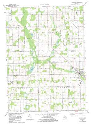
Litchfield Topo Map Michigan
To zoom in, hover over the map of Litchfield
USGS Topo Quad 42084a7 - 1:24,000 scale
| Topo Map Name: | Litchfield |
| USGS Topo Quad ID: | 42084a7 |
| Print Size: | ca. 21 1/4" wide x 27" high |
| Southeast Coordinates: | 42° N latitude / 84.75° W longitude |
| Map Center Coordinates: | 42.0625° N latitude / 84.8125° W longitude |
| U.S. State: | MI |
| Filename: | o42084a7.jpg |
| Download Map JPG Image: | Litchfield topo map 1:24,000 scale |
| Map Type: | Topographic |
| Topo Series: | 7.5´ |
| Map Scale: | 1:24,000 |
| Source of Map Images: | United States Geological Survey (USGS) |
| Alternate Map Versions: |
Litchfield MI 1980, updated 1980 Download PDF Buy paper map Litchfield MI 2011 Download PDF Buy paper map Litchfield MI 2014 Download PDF Buy paper map Litchfield MI 2017 Download PDF Buy paper map |
1:24,000 Topo Quads surrounding Litchfield
> Back to 42084a1 at 1:100,000 scale
> Back to 42084a1 at 1:250,000 scale
> Back to U.S. Topo Maps home
Litchfield topo map: Gazetteer
Litchfield: Airports
Claucherty Airport elevation 299m 980′Litchfield: Canals
Lampson Run Drain elevation 302m 990′McIlwain and Extension Drain elevation 302m 990′
Worthington and Billman Drain elevation 302m 990′
Litchfield: Lakes
Frier Lake elevation 297m 974′Quaker Lake elevation 300m 984′
Whitcomb Lake elevation 303m 994′
Litchfield: Parks
Clarendon Township Park elevation 296m 971′Congregational Church of Litchfield Historical Marker elevation 314m 1030′
Fireman's Park elevation 311m 1020′
Litchfield: Populated Places
Bentleys Corners elevation 311m 1020′Butler elevation 309m 1013′
Litchfield elevation 312m 1023′
Litchfield: Post Offices
Butler Post Office (historical) elevation 309m 1013′Litchfield Post Office elevation 311m 1020′
Litchfield: Streams
Sand Creek elevation 302m 990′Soap Creek elevation 299m 980′
Litchfield digital topo map on disk
Buy this Litchfield topo map showing relief, roads, GPS coordinates and other geographical features, as a high-resolution digital map file on DVD:
Northern Illinois, Northern Indiana & Southwestern Michigan
Buy digital topo maps: Northern Illinois, Northern Indiana & Southwestern Michigan


